The Conversation (0)
Viral
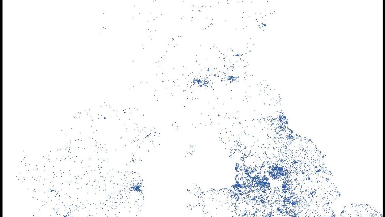
This map of Britain and Ireland drawn from pubs was made by Ramiro Gómez, a Berlin-based developer and "data explorer".
Gómez created the graphic using data from OpenStreetMap as an experiment, and he chose Britain and Ireland because we have so many pubs.
"I was curious whether OpenStreetMap coverage of certain location types is enough to draw recognisable regions/countries," he told i100.co.uk. "[It was] just a fun project really."
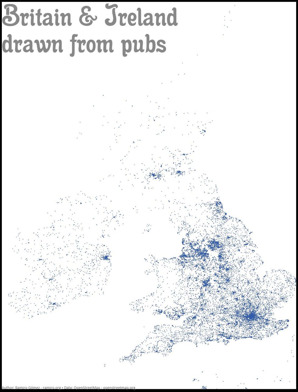
The resulting image plots about 29,000 pubs and is surprisingly similar to an actual map. You can read more about how it was made here.
More: A map of the world according to each country's favourite beer