


The Conversation (0)
Greg Evans
Jan 23, 2020
Picture:
IBEC/Screengrab
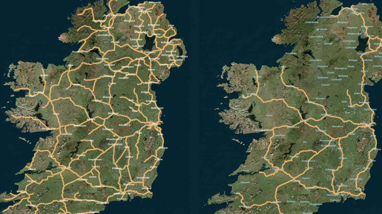
A viral image comparing the rail network in modern-day Ireland to the one that existed 100 years ago has gone viral as the latter is actually better.
This comes after the Irish Business and Employers Confederation published a special report, highlighting the values of having a shared economy between Ireland and Northern Ireland.
The report, which is available online, features two maps comparing the Irish rail network of 2020 and that of 1920 shows that there were far more connectivity and rail links across the entire island than there is today.
Almost the entire island has been depleted of train stations. This is mostly due to government cuts in the 1990s.
As the population in Ireland declined, there was less demand for trains so a considerable number of stations were decommissioned, with Ulster feeling the brunt of this.
The only remaining link that is currently shared is the line between Dublin and Belfast but even with that the network still falls below that expected of a contemporary European network.
Although, IBEC concede that returning to the network available in the 1920s they do suggest that a short term solution should be an hourly service between Belfast and Dublin, with the goal being a high-speed service between Belfast, Dublin and Cork.
The above tweet has already been shared more than 3000 times but it would appear that the 2020 version of the map is not fully up to date.
As it was pointed out in the replies, there is a line between Cork and Midleton in the south of Ireland but the line between Waterford and Rosslare in the south-east no longer exists.
Regardless, people have been completely dumbstruck at the revelation that a rail network in the 21st century is actually inferior to one from the previous century.
HT IBEC
More: Drop everything and read this woman’s viral thread about helping a stranger on the train