The Conversation (0)
Picture:
Carto Metro/Franklin Jarrier screenshot
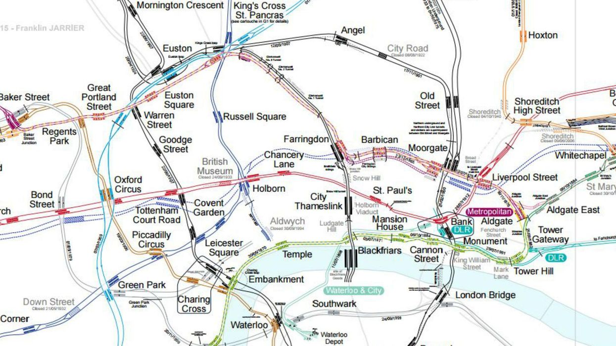
A beautifully detailed map of the London Underground and rail services across Greater London is the only map you will ever need.
Created by Franklin Jarrier and spotted by the New Statesman's City Metric blog, the map contains a treasure trove of details absent from the classic design by Harry Peck that we all know and love.
The full map was designed in 2015, and can be perused at your leisure, or when you should be working, here.
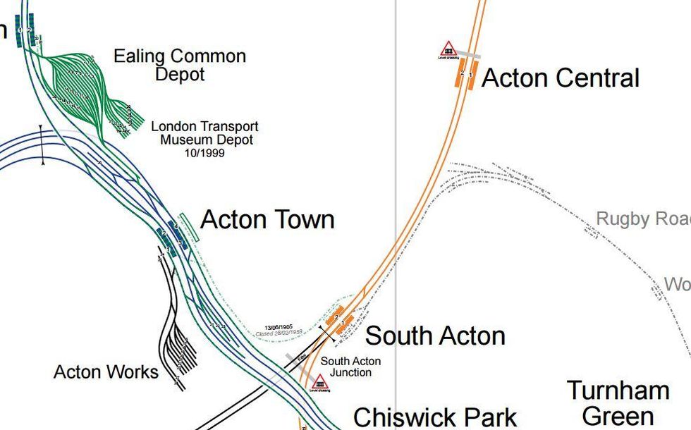
The detail is astounding, every siding is shown, as is the date for every bit of track and every station.
In addition to showing the real geography of the tube (shown in this gif), the map by Jarrier shows ghost stations, depot grounds, and the location of platforms beneath the ground.
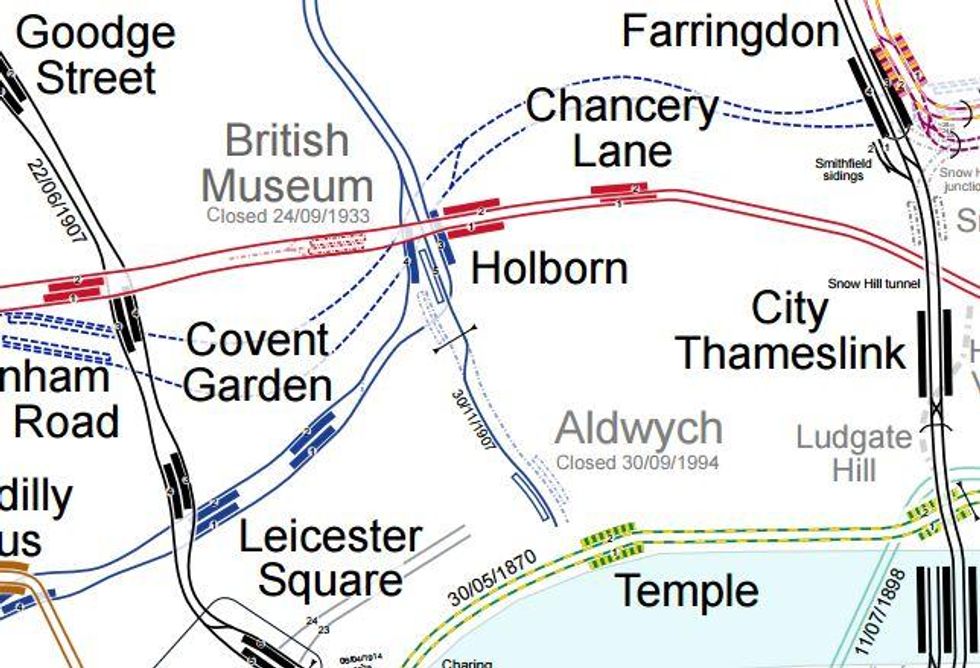
Ghost stations
The map shows a number of tube stations that once existed on the tube, or ones which were never opened despite being built.
For instance 'Aldwych' (at, well, Aldwych) which was Picadilly line branch that closed in 1994. Today the station is used a filming location when companies want a London Underground platform.
 Picture: Carto Metro
Nearby is the old Central line station 'British Museum', closed in 1933.
In total 81 'closed' stations and branch lines are shown on the map.
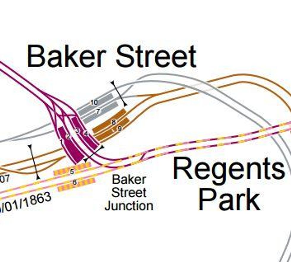
Platforms
The map also shows which lines run through each station, and where the platforms are in relation to one another.
Anybody who's had to trek between the Northern Line and Central Line, supposedly both at 'Bank' will be grateful for this feature.

It also demonstrates how crowded some stations are in terms of lines and platforms.
Miscellaneous!
Other fun details include the location of depots, the location of level crossings, and the track loops on certain lines.
Enjoy your nerdgasms.
HT City Metric
More: This man raced a tube train and filmed the whole thing
Top 100