The Conversation (0)
News
A map of the world hundreds of years old has been making the rounds online.
 Piri Reis
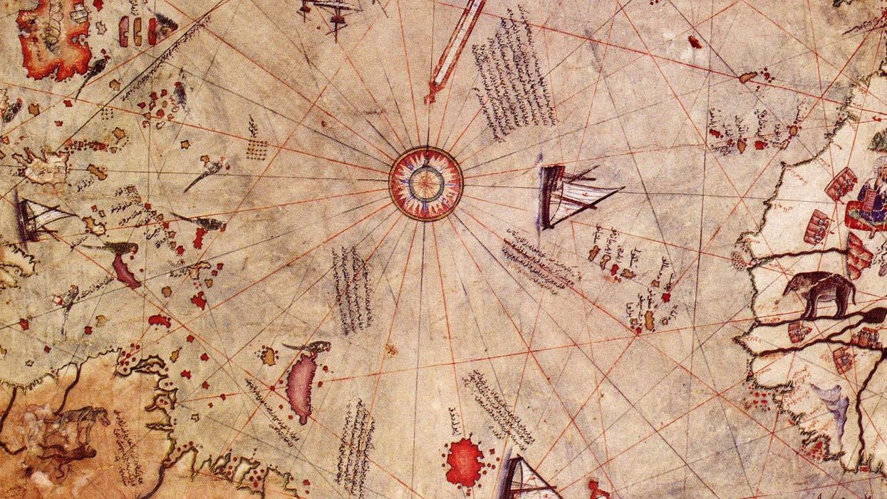
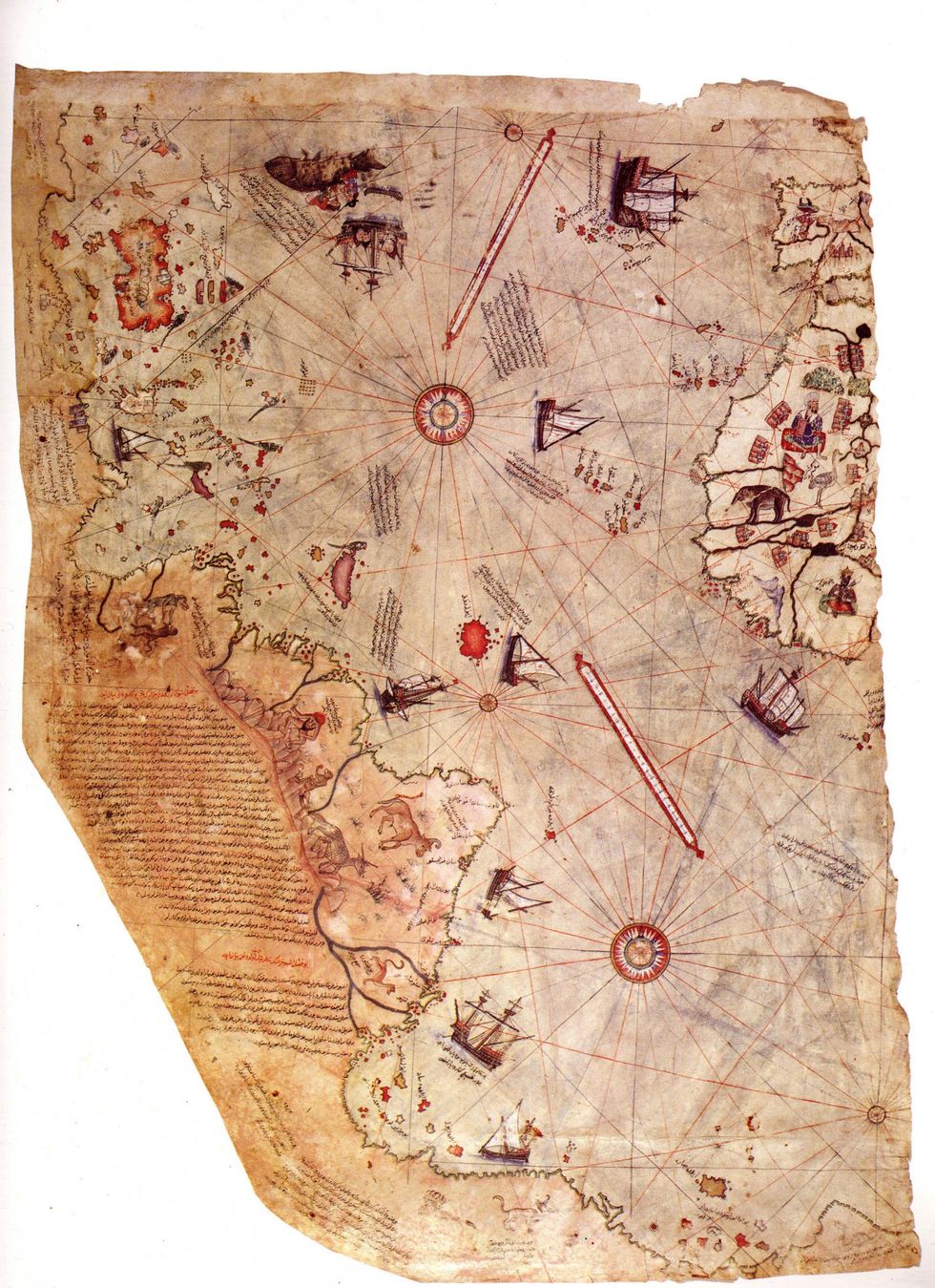
The map was compiled by Ottoman admiral and cartographer Ahmed Muhiddin Piri, or simply Piri Reis in 1513 in Constantinople. It also depicts the coast of Brazil and, to the bemusement of many, a supposedly ice-free Antarctica.
The internet has spewed forth a number of theories about ‘The Inexplicable Map’ as it has been called. The most intriguing element of the cartography is the placement of what many perceive to be Antarctica: not only is it free from ice, but it also appears to be connected to South America.
This has prompted the theory, pioneered by Harvard-educated historian Dr Hapgood, that the map depicts Antarctica from a prehistoric time. This would suggest that a much older civilisation mapped the Antarctic coast.
Given that Antarctica was discovered in 1818, not 1513, the depiction of the topography in the region presents the mystery – how did Reis have information on a pre-glacial Antarctica?
Reis admitted, in a note on the map, that he had used approximately 20 source materials, including charts and maps from both historic and contemporary cartographers to make his own. An expert on the map, Gregory C McIntosh pointed to one potential explanation for the confusion, in his book, ‘Piri Reis Map of 1513’, he wrote:
Arab writers often confused Claudius Ptolemy, the geographer of the 2nd century CE, with Ptolemy I, one of Alexander’s generals and the first Ptolemaic ruler of Egypt, who reigned from 323 to 285 BCE.
Piri Reis has undoubtedly made the same error, resulting in his believing the chart and maps were from the time of Ptolemy I instead of Claudius Ptolemy.
McIntosh took discrepancies in North American geography to be a characteristic of contemporary cartographical confusion with Asia - not something exclusive to Reis,
The simplest explanation is that the land mass in question is not a depiction of Antarctica. Either it shows Terra Australis, a hypothetical continent depicted in many maps of the time assumed to exist as a counterbalance to land masses in the northern hemisphere, but not yet explored. Reis may have extended South America to be part of this mass, or he drew a heavily distorted version of the coastline.
More: This map of Earth is the most accurate ever produced, and it looks completely different