The Conversation (0)
News
The Met Office has issued a yellow weather warning ('be aware') for much of the country, with a so-called "weather bomb" bringing storm-force winds and giant waves to our shores today.
The weather bomb, also known as an "explosive cyclogenesis", is classified by a 24 millibar drop in pressure within a 24-hour period - this weather system is set to hit Britain and Ireland today with effects lasting through Thursday.
This intense drop in pressure sees dry air from the stratosphere flow into an area of low pressure, which in turn causes air in the depression to rise rapidly, spiral, and create strong storm winds, as the Met Office explains in more detail here.
The Met Office has warned people to expect possible travel disruptions and coastal flooding in some areas.
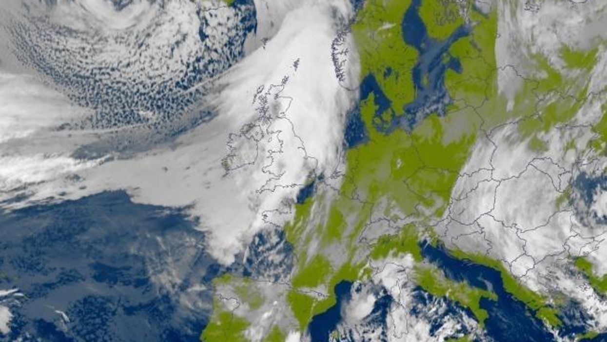
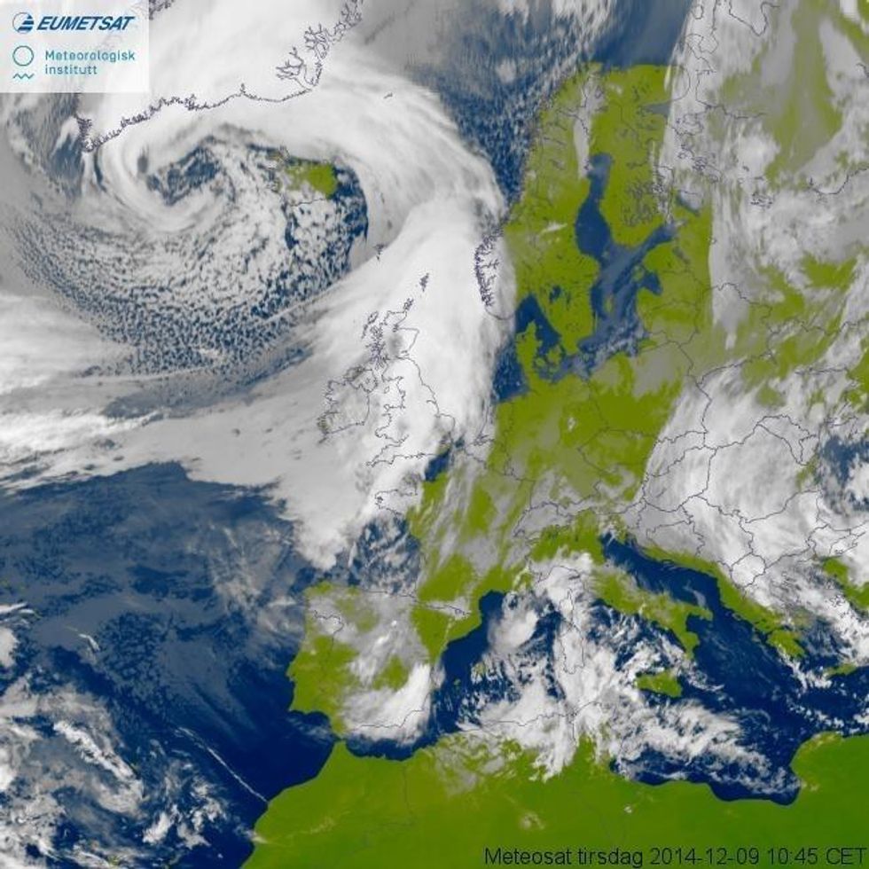
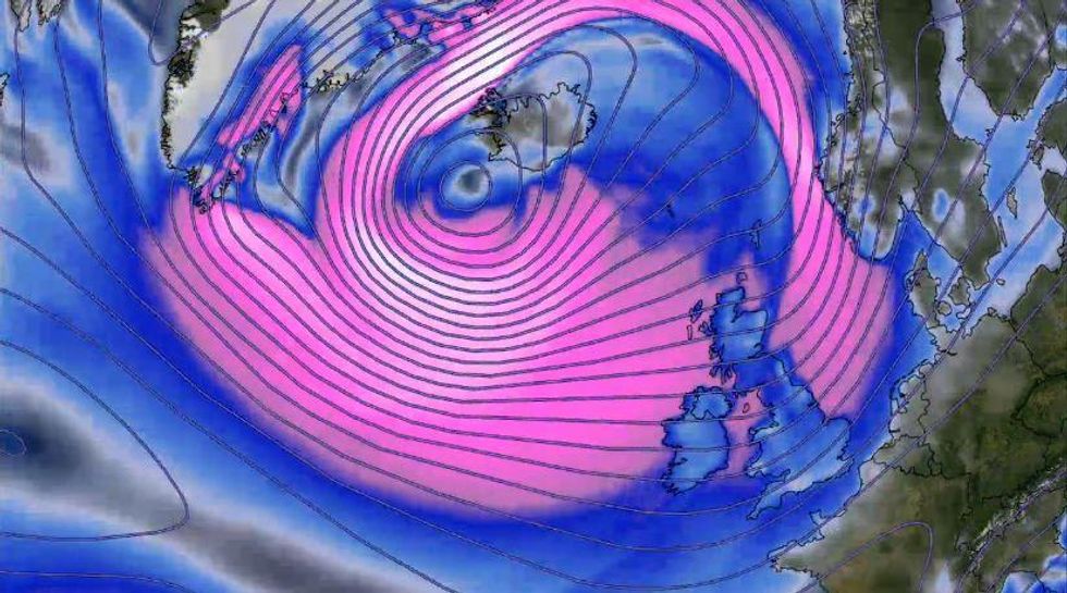
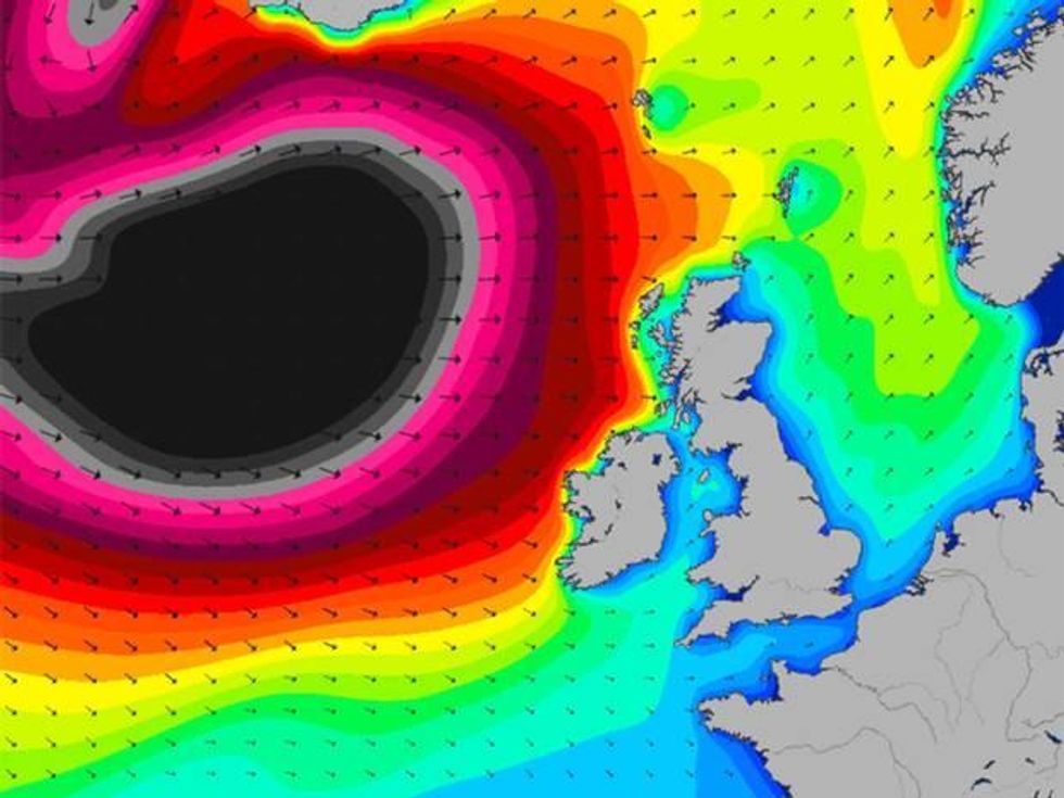
Here are five maps that help show the scale of the weather bomb.
This image, taken by the EUMETSAT satellite and the Norwegian Meteorological Institute, shows the eye of the 2,000-mile wide weather system travelling from Iceland towards Scotland.
The pink on this map, from the Weather Channel in the US, shows winds upwards of 40-50mph. The storm is expected to deliver winds of up to 80mph in parts of the UK.
This visualisation, from the MagicSeaweed website that provides surf forecasts, shows the size of wave swell - the black area shows waves of 48ft and above.
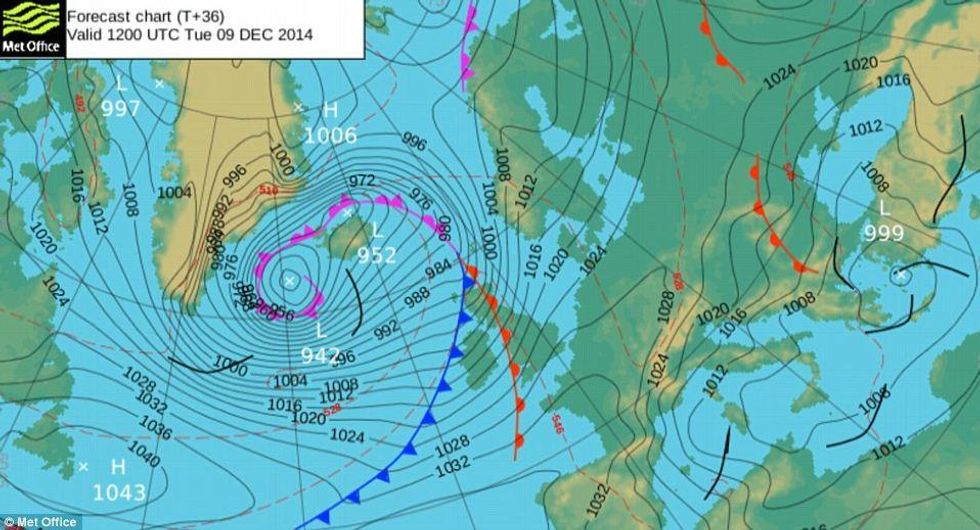
This chart from the Met Office shows the low pressure system of the explosive cyclogenesis forming over the north Atlantic yesterday.
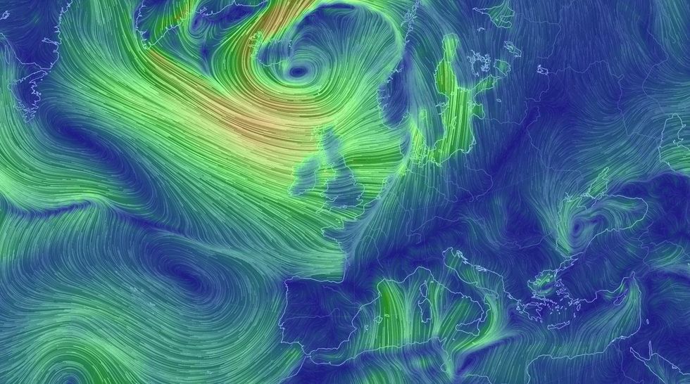
This map from earth.nullschool.net shows surface wind speeds.
More: The cold weather is making you bitchy, says science
More: This kink in the jet stream explains why it’s so darn hot right now