The Conversation (0)
News
See the world's conflict areas in perspective with these incredible images from Nasa.
The images were taken by teams on the International Space Station as it orbited the Earth.
Their full archive can be searched here.
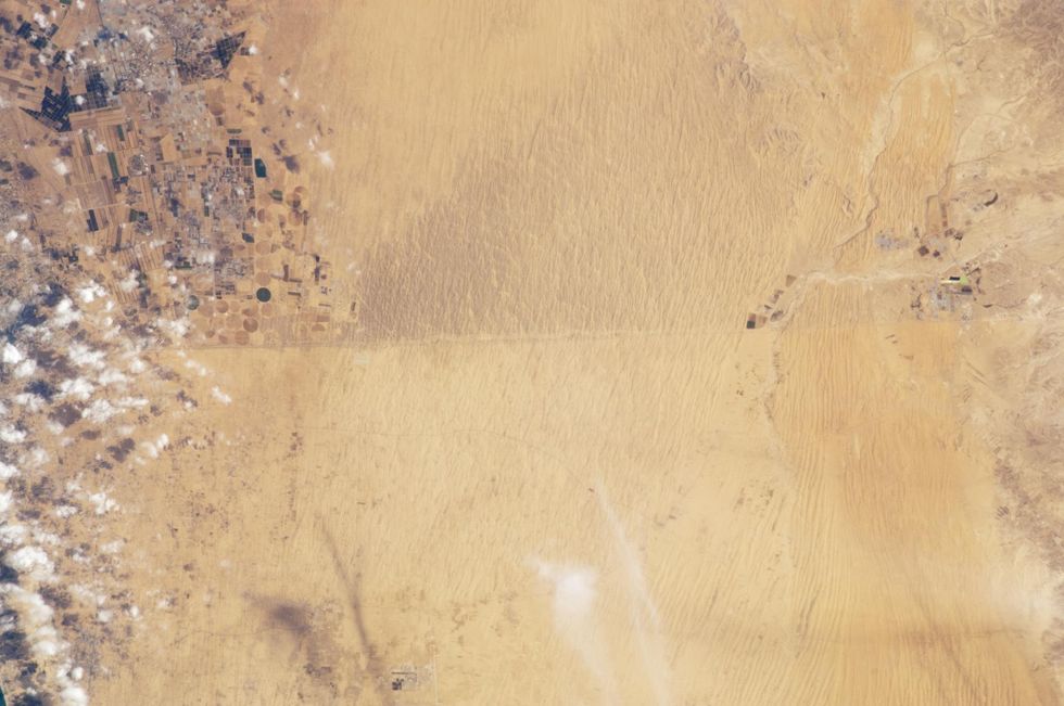
The two countries, who last formally went to war in 1967, have a visible border from a space in the form 50 kilometres of road.
For context, the Mediterranean Sea lies to the north-west.
 3 November 2011. (Picture: Nasa)
Israel lies to the North on the darker sand. Arable farming is what turned Egypt's soil lighter, south of the dividing line.
 7 November 2014. (Picture: Nasa)
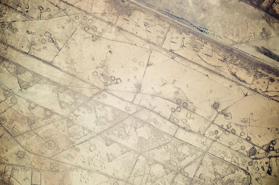
The war, which was at its bloodiest from 1980-1988, saw thousands killed. In this image, the border between Iraq (bottom left) and Iran (top right)
The lines running left to right across the image are 20 kilometre stretches of fortifications built during the war.
According to Nasa, the team on the ISS initially believed the lines were oil pad installations.
 23 September 2015. (Picture: Nasa)
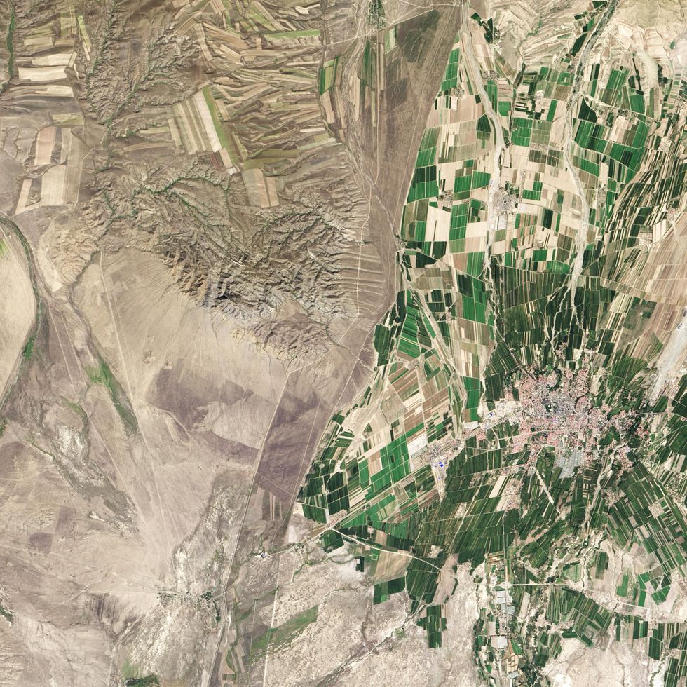
The yellow line marks the border between India and Pakistan, created when Pakistan was founded in 1947.
The border was the existing border of the five Muslim majority provinces in the north west of the British Raj.
One of these provinces Indus, named for the Indus River Valley, is captured in the photo above. The river valley spans the India-Pakistan border and is considered by some to be a cradle of civilisation.
The yellow line is in fact a series of bright security lights which mark the border. The countries have been on and off in an almost permafrost state of war.
Honourable mention goes to the Kazakh-China border. While the two countries are not in conflict, and share many mineral rights, their border is one of the clearest when viewed from space.
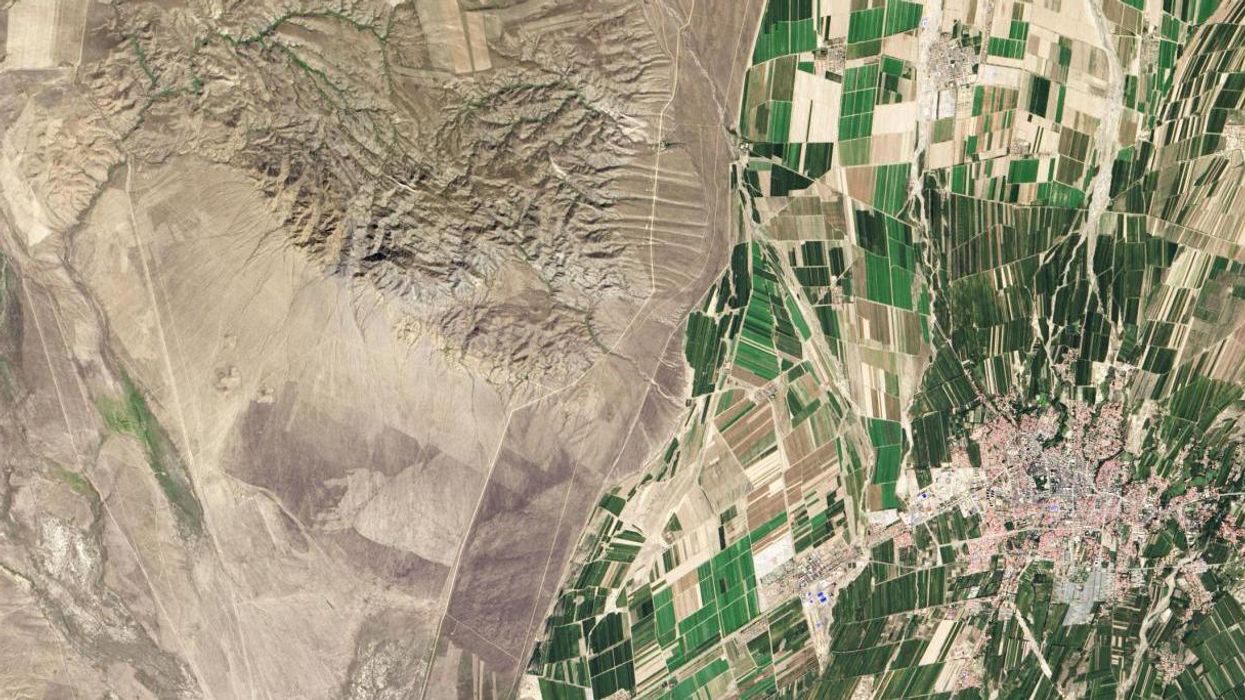
 9 November 2013. (Picture: Nasa)
The green pastures on the right of the image are China, Kazakhstan the sandier land to the left. It demonstrates the two nations differing agricultural situations.
In China, where fertile land is scarce, any and every inch of it is intensely farmed in small plots. The land has been irrigated heavily, producing the greenery of the image, in order to feed China's massive population.
By contrast Kazakhstan has large industrial farms, a hangover from Soviet collectivisation. Moreover the part of Kazakhstan pictured, the eastern area around Lake Balqash is not an area which is heavily farmed.
On the TV series the West Wing, a fictional dispute between Kazakhstan and China over oil served as a mission creep analogy for the real-life war in Iraq.
HT Time, Nasa Earh Observatory
More: Nasa asked the internet to name the 7 new planets...You know where this is going