


The Conversation (0)
News
If you work in London there is a strong chance that you've brought coffee or sarnie from a Pret a Manger.
It's not an exaggeration to suggest that within central London there is a Pret on every street and nearly every corner.
Other sandwich shops are of course available.
But what does that say about the capital in comparison to the rest of the country?
For instance, in the UK's second biggest city, Birmingham there are just four Prets in the city centre, which is one more than there is on Tottenham Court Road.
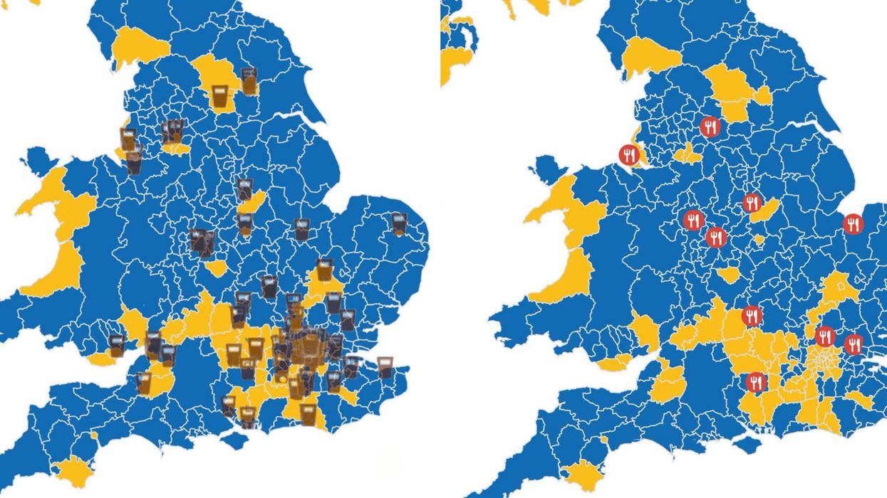
With that in mind, Twitter user James Gilmour layered the locations of all the Pret's in the UK on top of the EU Referendum vote outcome by region, and it is quite revealing.
Nearly all the areas that have a Pret had a majority remain vote, while the rest of the county, which doesn't have Prets, voted overwhelmingly to leave.
As we've pointed out, Prets are predominantly found in city centres where the population is more diverse, however, it does provide some food for thought.
The Pret location map was originally created by the Twitter account Election Data and if you can view the interactive version via Carto.
James also compared the few remaining branches of Wimpys in the UK to the EU referendum data.
The maps definitely sparked some interesting discussions after they were published on Twitter.
More: These charts made of sandwiches explain why you can't afford a house