The Conversation (0)
Viral
Artist and urban planner Neil Freeman, makes maps of tube systems.
He creates them using data from OpenStreetMap, and cartography software which he himself wrote.
They’re pretty damn beautiful.
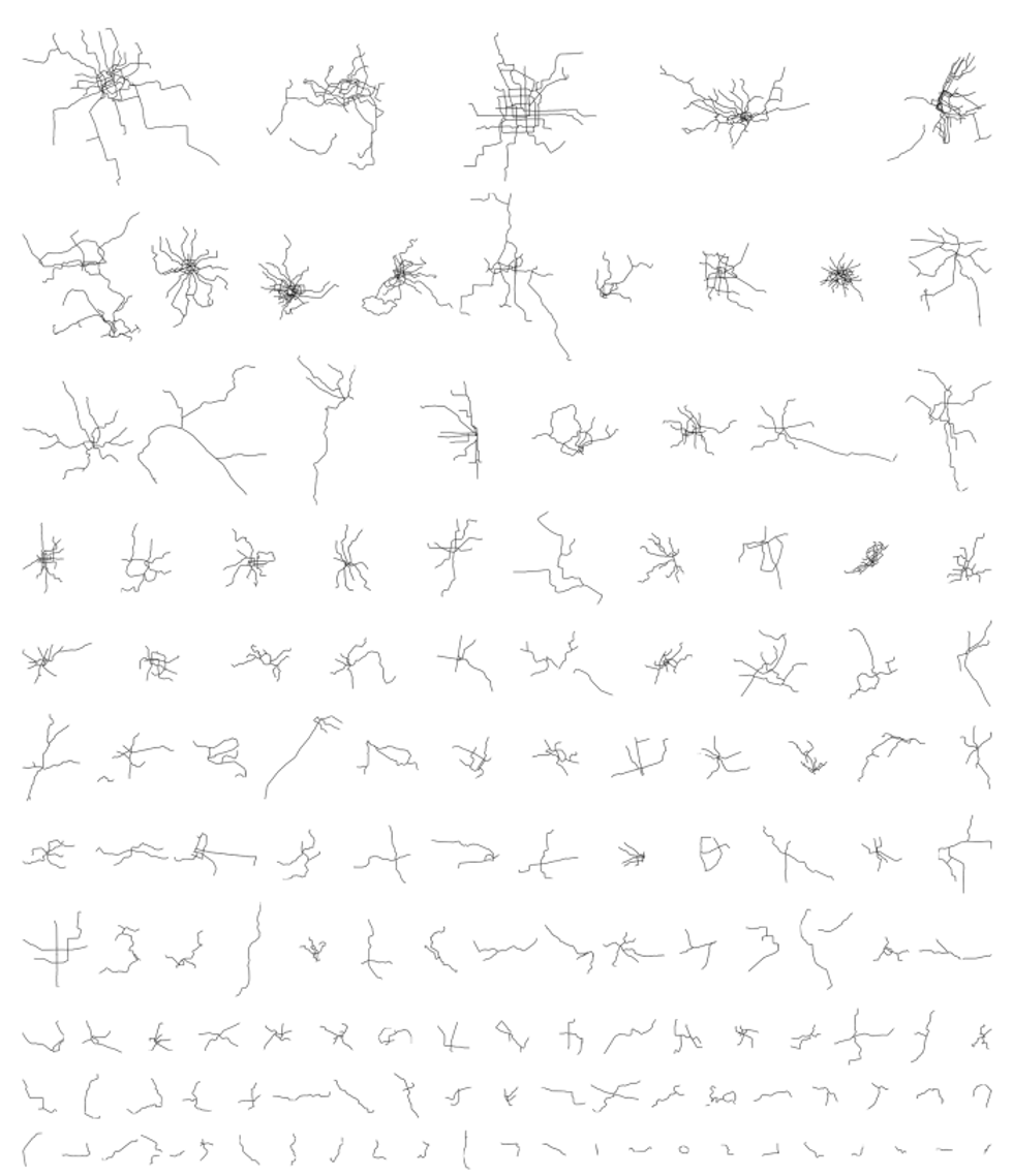
Neil has mapped nearly all of what he calls Subways:
Subway is an Americanism for 'metro' or 'rapid transit.' Unfortunately, there’s no real definition of what a 'metro' is. You can’t go by the name of the system - there are some 'metro' systems that are just trolleys, for example.
My goal is to map systems that fit into the same class as the New York City subway, the London tube and the Paris metro. That is, high-capacity, high-frequency, grade separated, heavy rail.
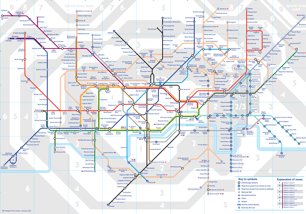
He decided to do this because maps of the systems are generally designed for ease of use, rather than geographic accuracy - when you think of the London Underground, for example, you're probably thinking of this:
This means that people have two mental images of the city - a surface-level map and an underground map. Exposing just the geographically accurate subway map is a way to help people think about those two mental images.
Also, looking at the subway map alone is an interesting way to try to understand a city from minimal information.
We agree Neil. Therefore we've decided to make a quiz, using his maps, to test your knowledge.
Take the quiz, below:
All images, unless otherwise states, courtesy of Neil Freeman
More: You should never be seen with these books in public
More: Quiz: Can you name the London Underground line by its colour?