The Conversation (0)
News
For most of the UK, if we're standing on the coast we know what land mass we'd next encounter if we swam out in a straight line.
It's probably going to be somewhere like France, or Ireland, or the US, or Norway, or the Isles of Wight or Man or Skye or Orkney or Shetland.
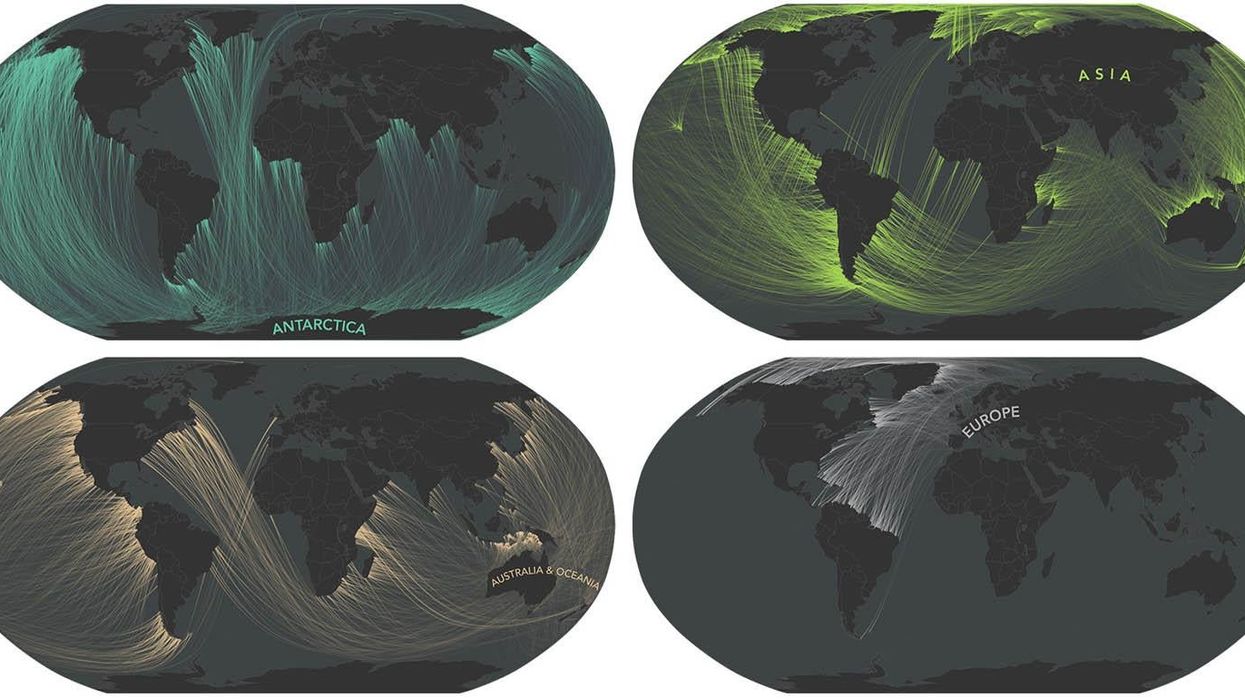
Due to the curvature of the earth, and the fact that coastlines are jagged and full of inlets and outcrops facing different directions, the place you'd actually end up would probably surprise you, as these beautiful maps show.
Andy Woodruff is a cartographer at Axis Maps - a small company that designs and builds custom web maps - and he is a board member of the North American Cartographic Information Society (NACIS).
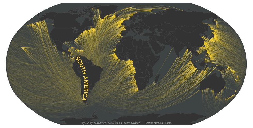
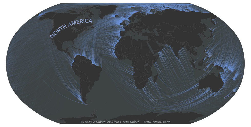
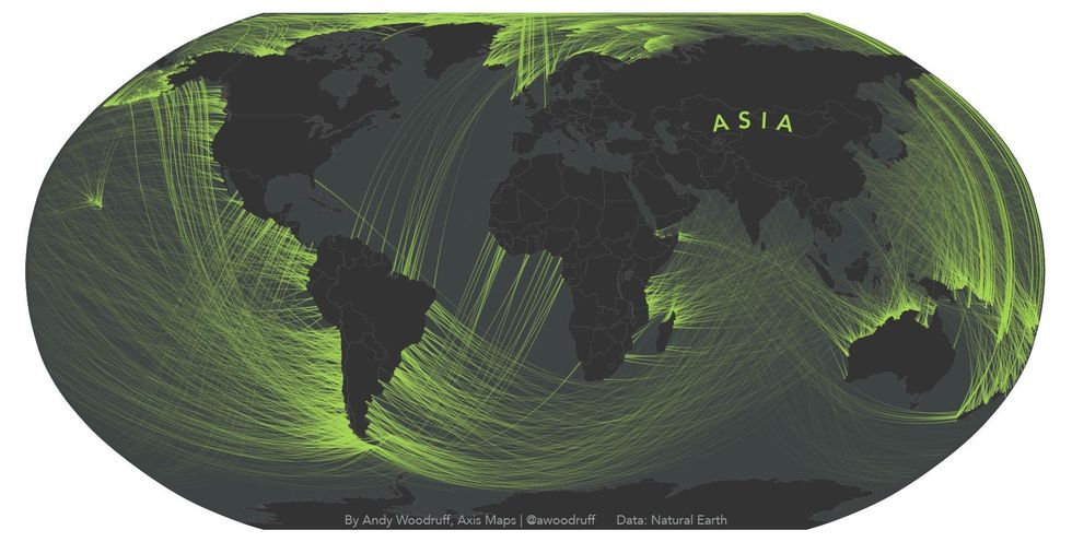
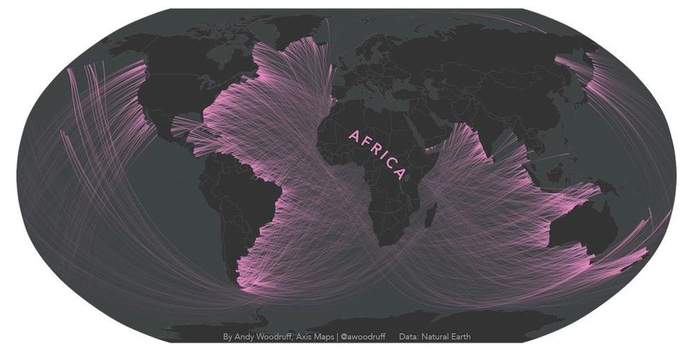
Andy has created a series of maps which reveal the continent that you are actually looking at from any given coastline - with each coloured line showing the real direction you're facing:
Previous maps have tried to do this - from which Andy drew inspiration - but crucially they don’t take into account the curvature of the earth and the fact that coastlines are crooked.
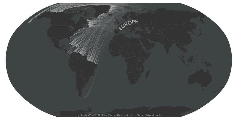
For example, on the east coast of the US most people would assume they're looking out at Europe - but you could actually be looking at Africa, South America or Asia, depending on where you stand.
In fact, Andy worked out that from the number one beach in his life, 30th Street in Ocean City, New Jersey, he would be facing Brazil.
Andy told indy100:
The most surprising results to me are probably the lines between North America and Australia. I had no idea that was possible.
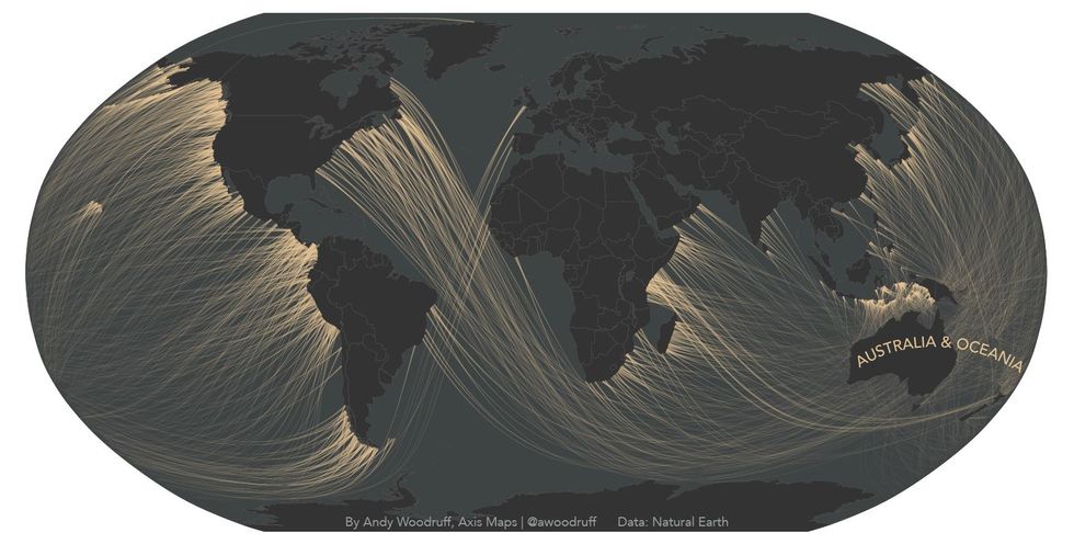
The busiest coastline is probably the Atlantic side of South America, which from various points can "see" every other continent.
As for the longest line, in my data it's probably one of those from North America to Australia.
Andy tells us that supposedly the longest straight line in the world in which you can sail is from Pakistan to Siberia, around the cape of good hope and the bottom of South America, then across the pacific.
But how does Andy make the maps?
The 'how' of these maps is a little messy, but in short I wrote some javascript code, specifically the D3 library, to make measurements and draw lines from a lot of coastline points, then finished up design work in Illustrator. It wasn't very efficient but it's what I know!
Andy says he's not sure what he has planned for is next project:
The fun ideas just kind of come up randomly.
His advice to budding cartographers is to "keep thinking geographically and to learn from examples of good maps you see, both in terms of design and technology."
If you do, who knows? Maybe one day you can make maps as gorgeously well-presented as his.
HT Vox
All pictures courtesy of Andy Woodruff
More: These maps show how much alcohol is in the standard drink around the world
More: 19 thought-provoking maps that will change how you see the world