The Conversation (0)
Picture:
Danny Dorling, University of Sheffield
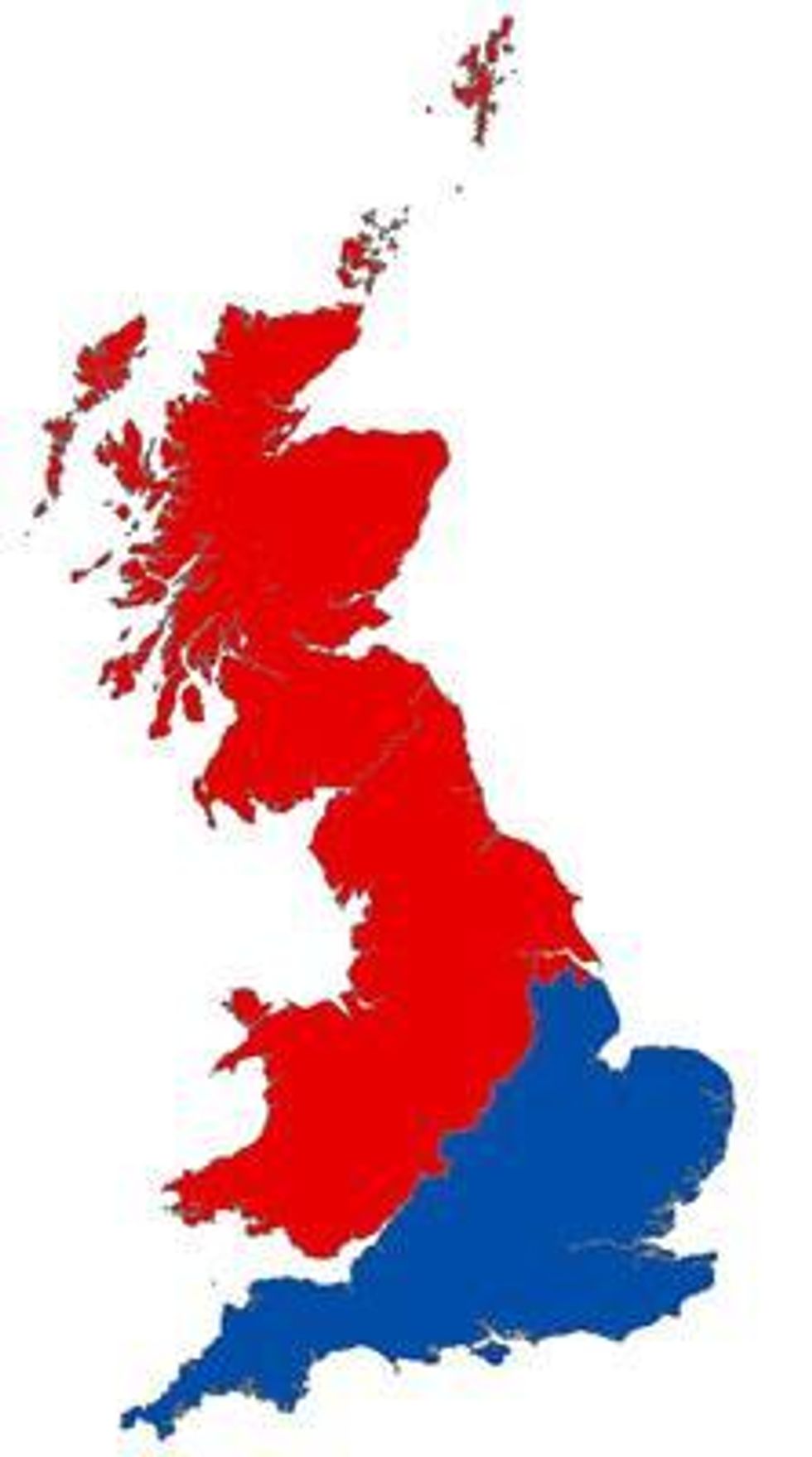
England has a longstanding north/south divide that has fuelled debates about the pronunciation of “scones,” arguments about what different meal times are called, and has underpinned humour behind sitcoms and stand-up comedians.
But while it might sound like a modern phenomenon, the divide goes back to the nineteenth century.
There are great differences between the north and south, including life expectancy and health, political leanings and poverty.
For example, in 1982, average earnings in London and the south east were, respectively, 121 per cent and 103 per cent of the national average. By 1997, this had risen to 137 per cent and 109 per cent.
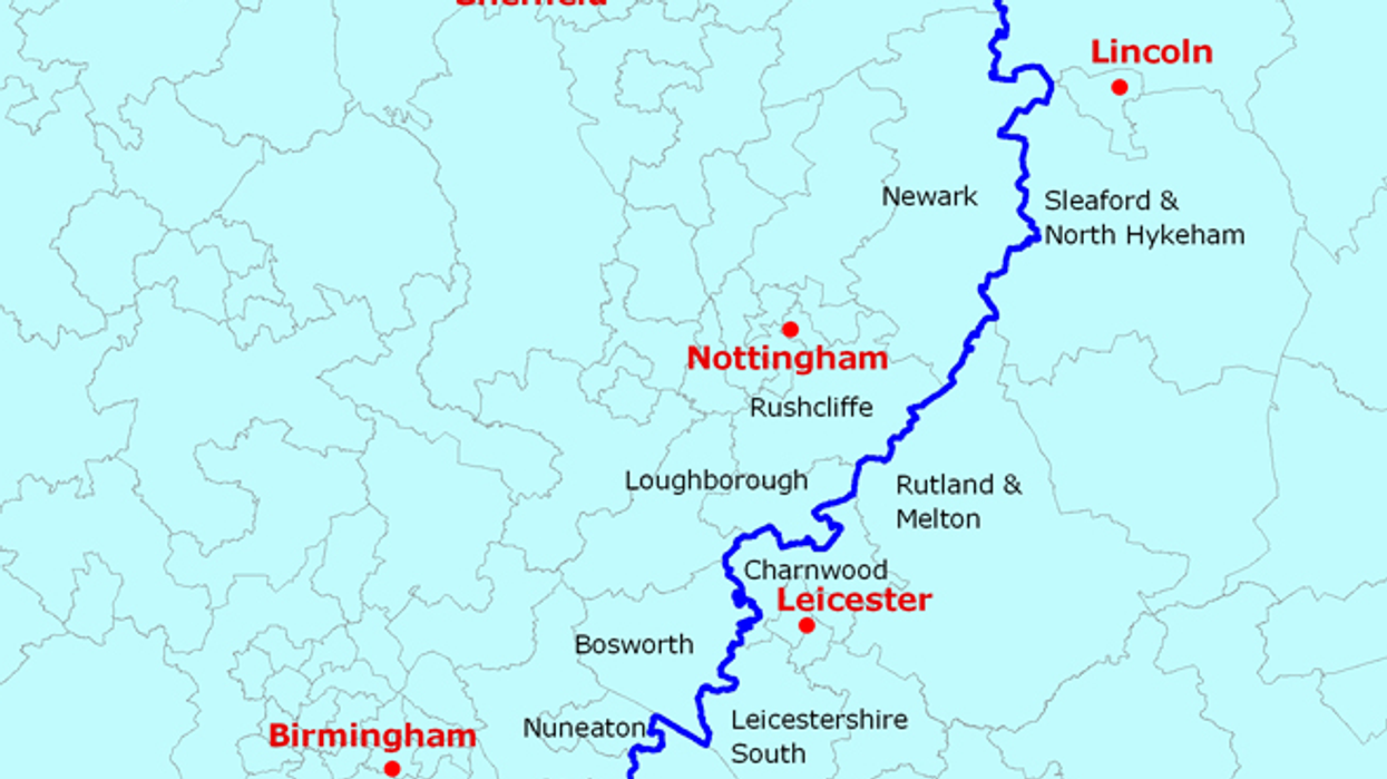
Where the divide lies, however, has been a source of contention. Poor Leicester sometimes doesn’t know whether it’s coming or going.
But the University of Sheffield has had a stab at drawing the line:
 Picture: Danny Dorling, University of Sheffield
Danny Dorling, former professor of Geography at the university, wrote:
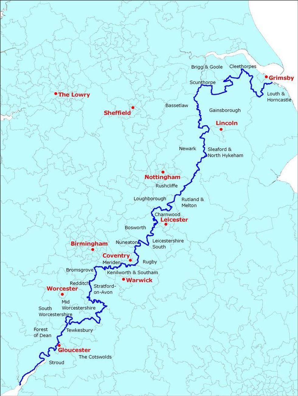
The closer you look at it the more detail you see. It weaves between fields and houses. That such an exact line can be drawn is, of course, a fiction but it is also fair to say that moving from North to South is not that gradual an experience.
The line lies above Gloucestershire, Warwickshire, Leicestershire and Lincolnshire, and runs below West and Mid Worcestershire, Loughborough, Scunthorpe, Cleethorpes and Great Grimsby.
Here's a closer look:
 Picture: Danny Dorling, University of Sheffield
Danny Dorling, University of Sheffield
Picture: Danny Dorling, University of Sheffield
Danny Dorling, University of Sheffield
What do you think?
Have your say in our news democracy. Click the upvote icon at the top of the page to help raise this article through the indy100 rankings.
Top 100