


The Conversation (0)
Conrad Duncan
Jul 24, 2019
These climate maps show the terrifying scale of this week’s European heatwave.
Europe has been hit by extreme hot weather for the second time in two months, after June was the hottest ever recorded.
Yesterday, a World Meteorological Organisation (WMO) spokesperson told a UN Geneva press briefing that heatwaves are becoming both more frequent and more intense.
She added that these examples of extreme weather also “bear the hallmark of climate change”.
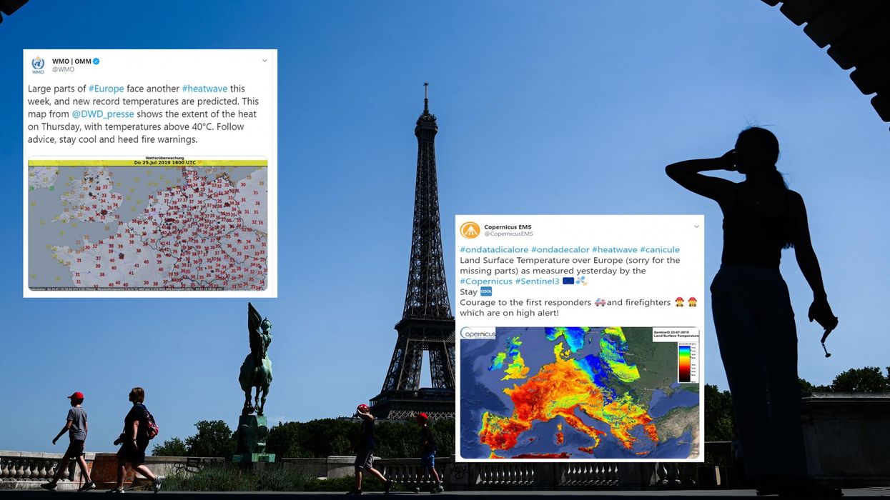
A map released by Copernicus EMS - an EU agency monitoring forest fires, floods and drought - showed the extent of extreme heat across the continent on Tuesday.
However, the worst heat is yet to come as much of Europe will be facing temperatures close to 40C on Thursday.
And while the UK has escaped the most extreme weather so far, that is likely to change later in the week - as the Met Office has said there is a 60 per cent chance that the record for the all-time highest temperature in the UK (currently 38.5C) will be broken.
The effects of this kind of heatwave can be severe.
On Monday, Copernicus released a “Fire Danger Forecast” for Thursday which showed much of Europe with “high” or “very high” danger of forest fires and almost all of France and Spain classed as in “extreme danger”.
The WMO has also released data which shows that many regions in France have seen virtually no rain since the last heatwave in June - worsening the country’s drought.
And in Belgium, a code red weather warning has come into effect for Wednesday and Thursday, which means the whole population (not just vulnerable groups) have been advised to protect themselves from the sun.
The UK also saw unusual weather last night as the Met Office recorded thousands of lightning strikes across the country.
The problems are not exclusive to Europe either...
In India, people are suffering from severe water shortages - partly caused by an extreme heatwave.
In short, the world is on fire…
None of this is normal - for example, the average July maximum temperature for London’s Kew Gardens is 23.5C, according to Met Office data from 1981-2010.
On Thursday, it is predicted to be 38C.