The Conversation (0)
News
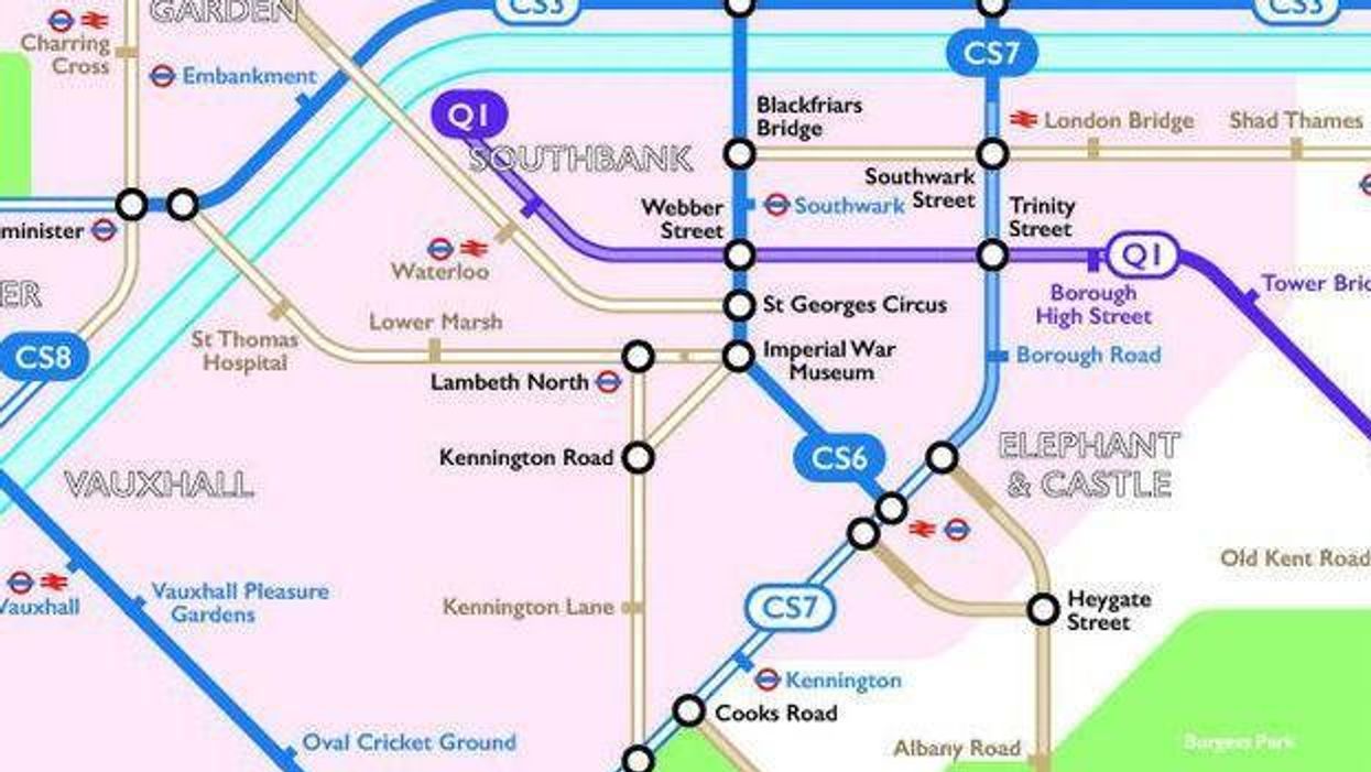
The beautifully adaptable map by Harry Beck of the London Underground has been used all over the world, and inspired several 'alternatives'.
One such is this excellent map from Route Plan Roll, which in 2016 created this map of London's cycle routes.
Cycling in the capital, despite the busy roads, has been on the increase.
In reassuring news, the number of cyclists being seriously injured or even dying has been declining, and remains low.
In part, the sturdiness of the downward trend in collisions and incidents can be attributed to the introduction of cycle super highways.
There are currently six 'super highways' that provide a route, often separate from the road, into central London from the outskirts. Construction is underway on an East-West, and North-South route respectively.
Route Plan Roll has updated its cycle map in April.
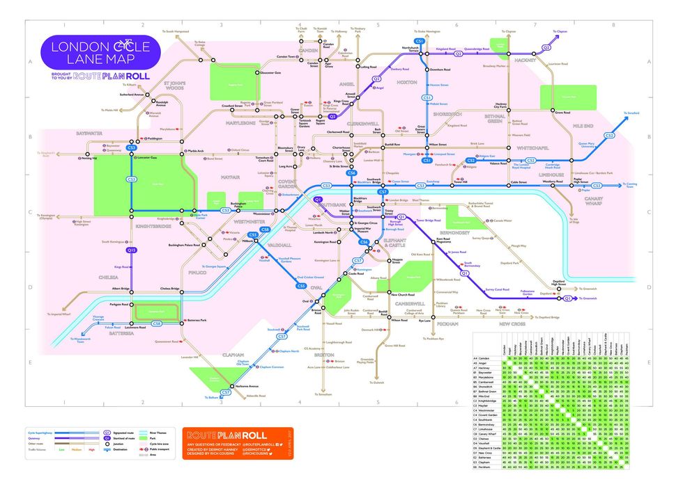
Click here to download and see the map in all its glory.
According to Route Plan Roll, the map is intended to make travelling by bike easier, and hopefully reduce the need for cyclists to use the distraction of GPS.
Speaking to indy100, the map's creator Dermot Hanney explained the reaction the map had received so far:
I think it has overall been very positive. People appreciate the ability to get a high level view of what infrastructure is currently out there for them in London. I think everyone, including myself, would like to see someday a GIS element added on where you can dig into the network in more detail at a local level but really at the moment I've trying to do this one step at a time, and that will need to wait for another day.
Despite the popularity, TfL have not been in touch about using the design or incorporating Route Plan Roll's work into their iconic series of maps.
I have not had any formal contact. I've been too busy putting it together til now to force the issue, though of course I'm more than happy to discuss with them any aspect of the map. I have had some informal contact but it's only been on an individual level and not people with direct routes to decision making in this area. I'm sure as an organisation TfL are aware of the map at this stage but I have yet to get any requests for more information from them. Hopefully this is something I can pursue further now I feel the map is at the level I want.
Hanney told indy100 what his next big ideas were:
Go-pro (video) key routes to give reassurance of their quality and persuade those on the edge to cycle more
Create more localised maps for London to show more key local links and destinations, as the current April map is mainly focused at accessing Central London
Discuss with events/universities/TfL to in particular create bespoke maps to show how for example people may cycle to the Hyde Park concerts, the best cycle routes for students to university and their halls, and just simply bringing it all to a wider audience.
In conclusion, Hanney said
It's all about just making cycling more understandable and easier to undertake for everyone so this all helps.
HT Metro
More: A really simple change is saving thousands of cyclists every year