


The Conversation (0)
Wil Jones
Feb 20, 2017
Picture:
DeviantArt/stagyika
Earlier this month, the House of Commons overwhelmingly backed the Article 50 bill, confirming the UK will indeed leave the EU. We still don’t know when, mind, but it’s seems like it's actually going to happen now.
That's despite 48% of country having voted against it.
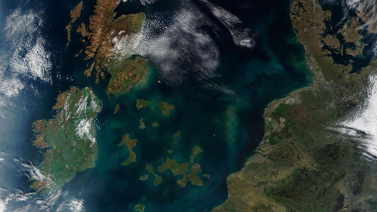
But that raises an interesting question:
What would it look like if the parts of the UK that voted to leave, actually physically left, and the pro-remain regions stayed where they are... As islands?
That’s what DeviantArt user Stagyika has created with this incredible map.
The land that remains are the local council districts that voted remain, and the water is, well, those that wanted to go.
Northern Ireland, we should point out, is slightly inaccurate on that map. As an entire region, it was pro-remain, but some individual local districts voted leave.
Obviously, London and Scotland are the big land masses, but the various archipelagos do well to break the idea that everyone in England outside the capital was completely anti-EU.
It's the most interesting post-Brexit map since the one that looked like Maggie Simpson
More: A map of Europe according to the number of people living abroad
More: A map of the US states earning the same amount as European countries