


The Conversation (0)
News
The state of Wyoming in the United States reigns supreme in quadrilaterality.
If you've ever seen its boundary, it looks something like this:
This is because the state borders were intended to be along lines of latitude and longitude, although due to 19th century inaccuracies, this isn't quite the case by roughly half a mile.
So how do countries stack up for being square, given that they were forged by conflict, diplomacy and tectonics?
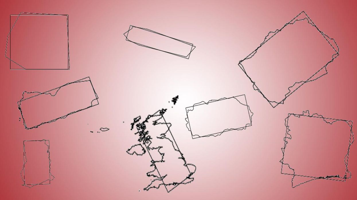
This is the question that David Barry sought to answer when a Facebook friend noted that Turkey was "a remarkably rectangular country."
He created an algorithm which defined the 'rectangularness' of a country as its maximum percentage overlap with a rectangle of the same area.
Using shapefiles from Natural Earth he then plotted countries for 'rectangularness', finding that Turkey only came fifteenth.
For reference, here are the top ten:
The UK ranked 159th, with a score of 0.763.
Smaller countries, due to the shapefiles, were represented as quite smooth shapes, which had an effect on the scores - David later recalculated the Vatican with a more detailed shapefile and the index score went from 0.948 to 0.890.
David told indy100 what surprised him most was that he:
thought Nepal would have been in the top 10, but it came in mid-20's - it has a more squiggly border than I'd thought.
David said if he were to do the project again he'd make a number of changes.
I thought 10 people would look at it instead of a hundred thousand!
In hindsight, I'd have taken the time to a) re-project each country so that the shapes are a good approximation of what they look like on the earth's surface (the equirectangular projection distorts badly at high latitudes), and b) tidy up the plots - just showing the main part of each country, instead of having the distant islands messing up the scales, or the problem where a country crosses 180 degrees of longitude.
When asked if he thought there were any interesting trends in the data, which reddit had jokingly tried to investigate, he demurred:
Rectangularity as such, no, I don't think that's a serious topic.
There is an existing line of research into countries with straight line borders - the idea being that colonial powers often defined countries by drawing straight lines on a map, without paying attention to various existing local cultures and where those people lived.
Alesina et al. have a paper on this, but this is not my area and I can't say how robust that research is.
David works in mining geostatistics, having previously produced analysis on the Australian election.
More: Quiz: Can you tell which country it is just by its outline? Europe edition
More: Quiz: How well do you know the geography of the capital cities of Europe?