The Conversation (0)
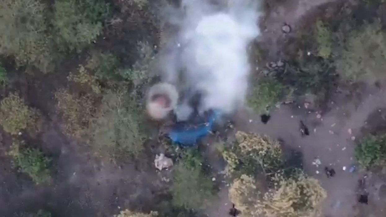
Mexican cartel uses drone to drop bombs on rivals
IndyTV
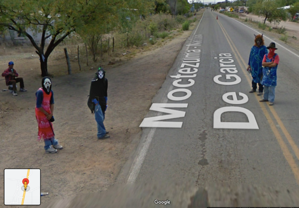
Google Street View users have stumbled across what appears to be Mexican cartel members wearing creepy masks online, and it’s one of the most terrifying things we could ever imagine seeing on the road.
Four men with their faces obscured are seen standing on a road in Moctezuma, which is found in the state of Sonora.
One is dressed as a werewolf and the others in a Mexican luchador face covering, a Scream mask and a balaclava.
The area is known for its connection with the Sonora Cartel, which was one of the most widely established in the country before it ceased operations around 15 years ago.
Reddit subreddit r/GoogleMaps shared the image, adding the caption “I just found the masked guys in Mexico”.
The post has sparked a big reaction online, with one saying: “Oh shoot damn must of been scary for the google maps driver [sic].”
 Are they hardened criminals? Or just kids messing around?Google Street View
Sign up to our new free Indy100 weekly newsletter
Another added: “That’s the cartel. You wanna stay far far away from those masks.”
“Aaah, they turn around to face the car as it drives by - so creepy!” one more said.
While it's impossible to be sure, it's either cartel members or people dressing up in terrifying Halloween costumes in the image. Still, it’s certainly not something you come across every day on Google Street View - and we wouldn't fancy coming across them either way.
It's one of the many anomalies to be found on Google Street View and Google Earth. Since it launched in 2001, Google Earth has changed the world, and also had a hand in a few cold cases being brought to light.
One incident saw the body of a man who disappeared 22 years previously was discovered after a Google Earth user spotted his car submerged in a lake.
A stealth bomber belonging to the US Air Force was also captured on Google Earth flying over a farm in Missouri recently.
Have your say in our news democracy. Click the upvote icon at the top of the page to help raise this article through the indy100 rankings.
Top 100