News
Dina Rickman
Aug 24, 2014

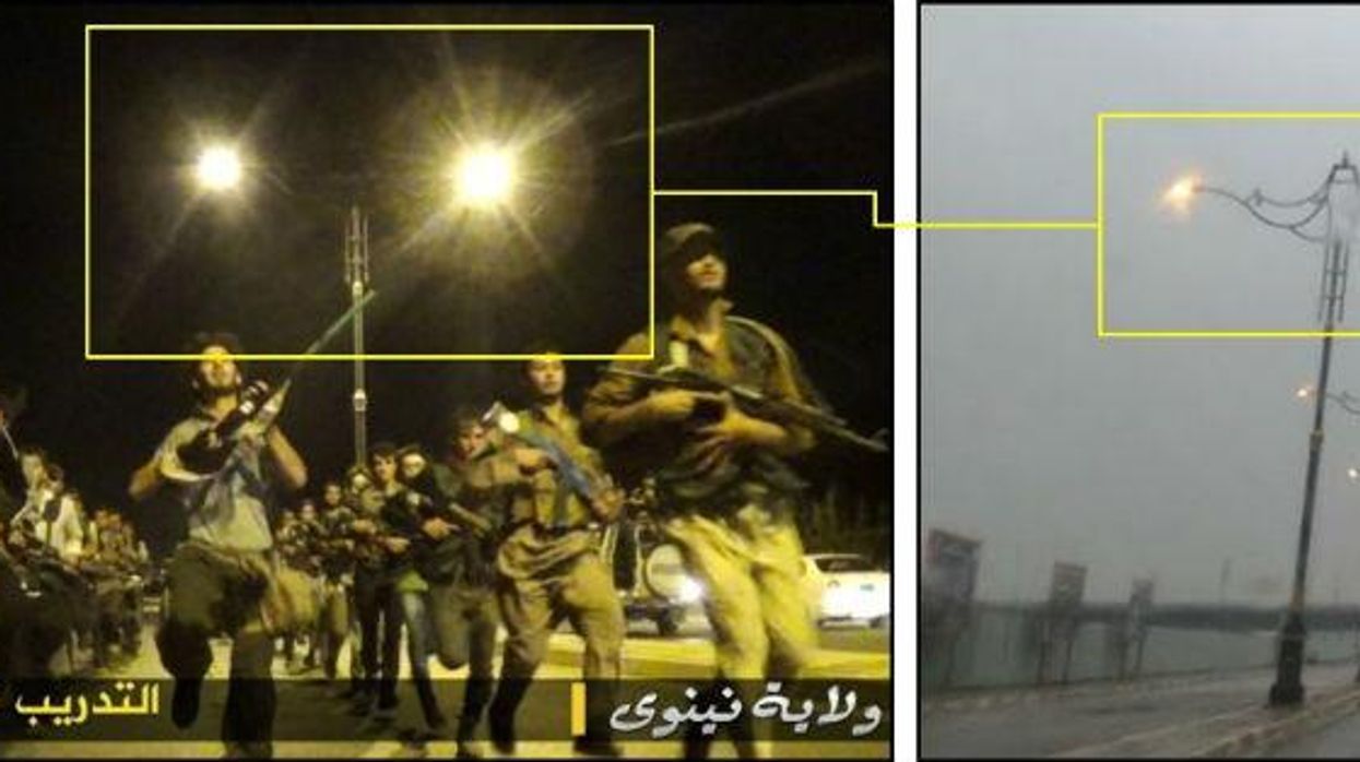
A crowdfunded website run by the British expert who exposed Syrian arms trafficking from his bedroom in Leicester more than 3,000 miles away claims to have found the location of an Islamic State (Isis) training camp using Google Maps. The site has also used similar tools in an attempt to locate the area in north Syria where James Foley was beheaded.
Bellingcat is run by Eliot Higgins, who began blogging about the Syrian civil war under the pseudonym Brown Moses in 2012. He specialises in analysing images and stills from videos posted online, and raised more than £50,000 via kickstarter to fund Bellingcat.
To identify the training camp, the site used stills from videos and pictures posted online by Isis, which they cross-referenced using Google Maps, flashearth, a site which uses Bing Maps, and panoramio, which tags the location photos were taken on a map.
As the Telegraph notes the site's findings, especially in relation to James Foley, could help provide a "breakthrough" as to the identity of the journalist's killer.
Top 100
The Conversation (0)


