The Conversation (0)
News
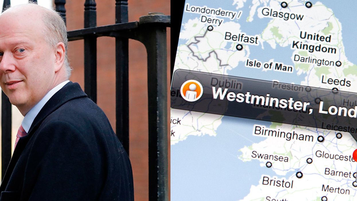
While the average person can almost always rely on Google Maps to get them from A to B, we’re not so sure government should be using it to draw up significant no-deal Brexit plans for all UK ports.
But this week, the chief executive of the British Ports Association, Richard Ballantyne, revealed that this might have very well been the case, accusing transport chiefs of using Google Maps to draw up the “very basic” and “simplistic” proposals for maritime chiefs.
With the Brexit deadline looming and fears that crashing out of the EU could lead to food and medicine shortages, experts are bracing for a potential ferry gridlock, citing particular concerns about an overflow in Portsmouth and Dover.
Ballantyne said some ports have been “alarmed”, fearing that government officials simply relied on Google Maps to draw up the plans, and calling for transport secretary Chris Grayling to make “robust efforts” to use “on the ground” information. He told Huffington Post:
Aspects of these seem to have been pulled together by measuring space available at ports and their connecting road networks in a very basic way
It’s even been suggested that this has used simplistic measures such as Google Maps, rather than any robust efforts to gather reliable information on the ground. This must be corrected.
Even more concerning is that nine town hall chief executives accused the government of using non-disclosure agreements to ban port bosses from sharing information. Grayling's secrecy has been a major cause for concern, with Andrew Gwynne, the shadow local government secretary, also writing a letter to communities secretary James Brokenshire, in which he says:
I understand that the network reported that there has been a lack of information and support that unless addressed, could result in a significant delay at UK ports after Brexit
This is not the first time the transport secretary, has been criticised over his Brexit planning. During a live rehearsal of an emergency traffic system in Dover in January, aimed at testing road capacity for extra traffic, Grayling was told it was a “waste of time” by drivers and “too little, too late” by the Road Haulage Association.
If only Brexit was as simple as using Google Maps.
HT HuffPost
More: This picture of a bus is the perfect metaphor for Brexit
More: Google Maps: Man divorces wife after he sees her with someone else on street view