The Conversation (0)
Peter Dovak descibes himself as "a lifelong transit nerd who recently began channeling that passion into graphic design."
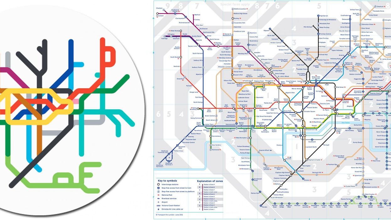
He has designed miniature versions of 220 maps - the above image for instance is of London.
Here are the rest (you may be scrolling a while):
Peter told indy100 it had been very exciting to see the response to his maps:
The maps were all created by hand in Adobe Illustrator. There was no special coding algorithm used; I am very bad with coding languages. As such, I doubt there will be an app related to them but I am open to collaborating with other app designers.
I wanted to use the official maps and colours from each system, but some were very hard to locate. It was difficult to find some of the maps from non-English-speaking countries, particularly ones which very recently added new lines.
It was also difficult to draw a line on which systems to include - to keep the scope not too daunting, I decided to limit the scope to just 'heavy rail' (metro / subway / tube) and 'light rail' rapid transit systems - which meant leaving out things like trams/streetcars and commuter/intercity rail lines. This upset some people, particularly some Australian cities such as Sydney which has a very metro-like commuter rail network, and Brisbane which has an extensive and popular tram system.
The most interesting map to recreate was the most complicated one - Seoul.
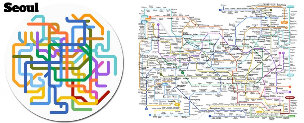
It was very challenging to squeeze in every line possible into such a small space. All of the extremely complex ones were an interesting challenge.
We asked him which city and rail network were his favourites. Peter told us:
It's hard to pick a favorite. The subway systems in Japan are always very impressive. I am also fond of Toronto and Montreal, where I visited just recently. I also adapted these maps into a way to display my personal ticket collection.
If you like the look of the maps, you can browse them on his website in detail, or buy transit specific gifts.
All images courtesy of Peter Dovak.
Top 100