


The Conversation (0)
Indy100 Staff
Jun 21, 2017
Picture:
iStock/Getty images/Reddit/RotatedTaco
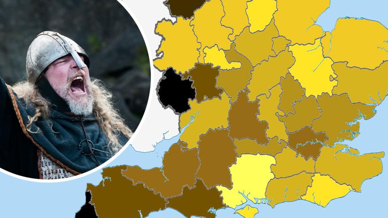
A new map of England was recently shared to a popular subreddit, which divided counties up by the proportion of blonde people in each county, as found by assessing men's casual football teams.
The reaction was immediate:
Vikings.
It's an easy joke to make, when you see the spread of the proportions. It seems we're more blonde in the East of the country than the West.
View the map, below:
Picture: Reddit/RotatedTaco
Accorging to the creator, the data was collected by looking at small/casual men's football teams in each county and the datasets for each county range between roughly 30 and 60 in size.
People pointed out this was a small sample size for analysis, which the creator conceded.
However, there's also a few other problems with the map.
The Vikings were not, it turns out, overly blonde.
Genetic studies have found that back then they were a healthy mix of blondes, redheads and dark-haired people.There were more blonde Vikings in the area that is now Sweden, but Danish Vikings in the West had mixed hair colours.
In addition, genetic studies of the UK have found that Anglo-Saxons affected our DNA far more than Romans, Vikings or Normans ever did.
So, if anything it'll have more to do with Anglo Saxons - but 1,000 years of diaspora around the UK probably has something to do it.
More: 52 things we all think to be true, but are actually false