The Conversation (0)
News
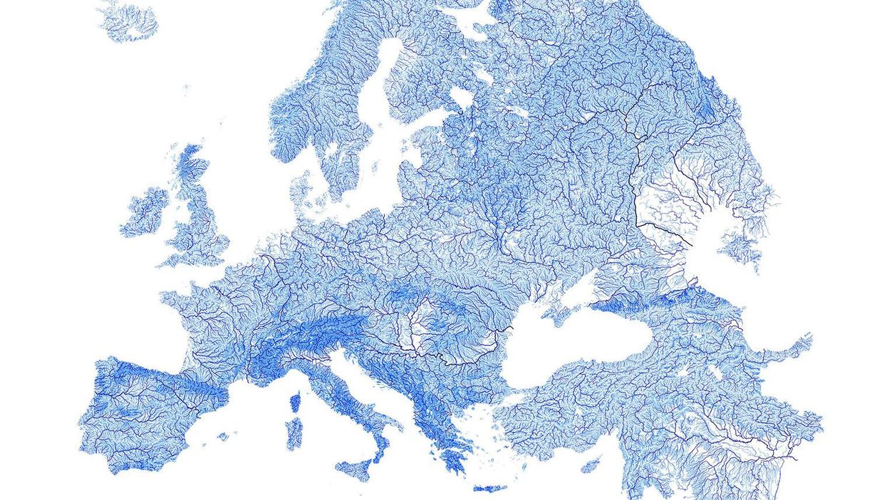
When we think about drawing lines in Europe, we tend to think more about country borders (or dare we say Brexit) than we do about rivers and streams.
However, doing so can have some pretty gorgeous results, as these maps show.
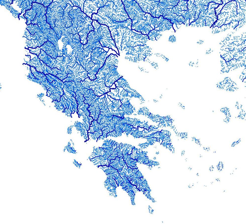
Robbi Bishop-Taylor is a landscape ecology PhD candidate at the University of New South Wales, Australia.
His research often involves geospatial mapping.
Using open-source QGIS using data for 1.35 million streams, he's made maps of Europe's waterways, to redraw our continent.
The rivers are weighted by Strahler hierarchies - ie the width of the lines is based on the number of tributaries each river has.
The results are somewhat beautiful:
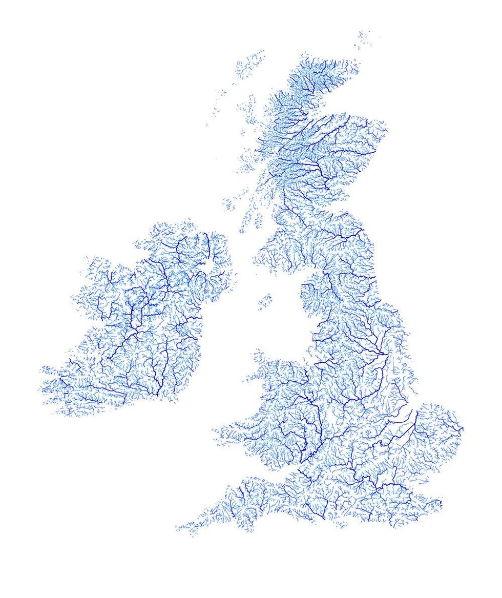
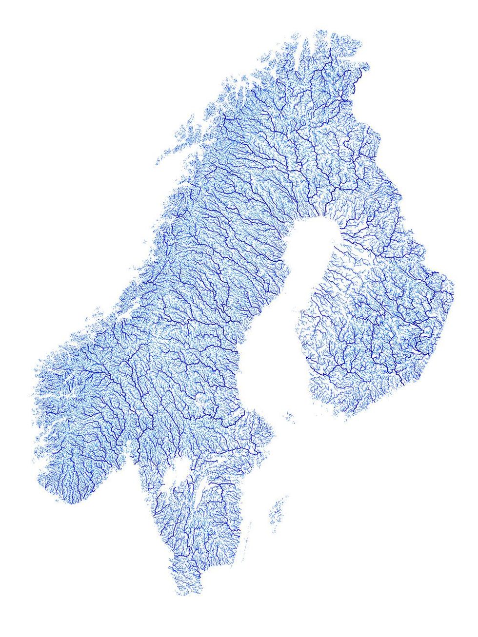
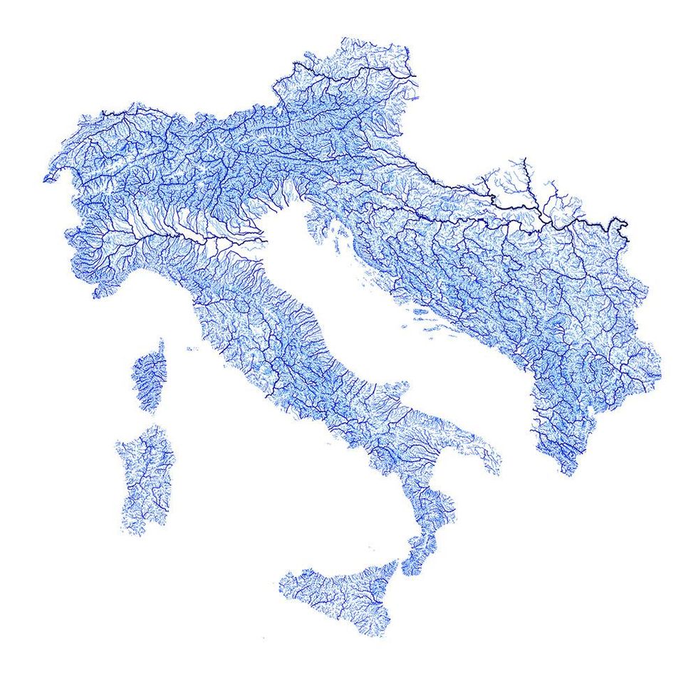
You can view and purchase Robbi's other prints on his Etsy online shop.
All images courtesy of Robbi Bishop-Taylor.
More: The beautiful maps that show all the roads leading to Rome
More: These beautiful maps will change your perspective of the world's coasts