The Conversation (0)
News
Eliot Higgins is the British analyst who, from his home in Leicester more than 3,000 miles away, helped expose Syrian president Bashar al-Assad’s use of Sarin gas.
The 35-year-old began blogging about the Syrian conflict as a hobby in 2012 under the pseudonym Brown Moses, after leaving a job in admin.
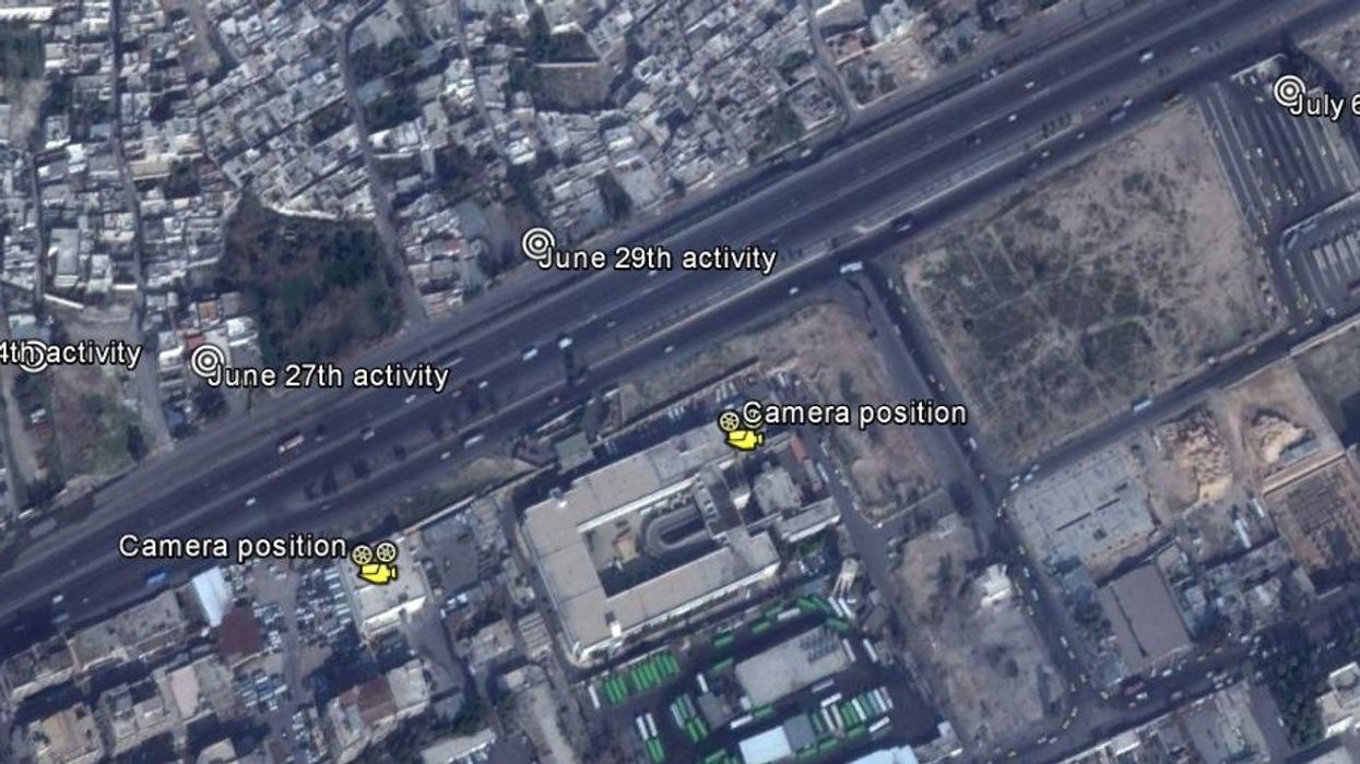
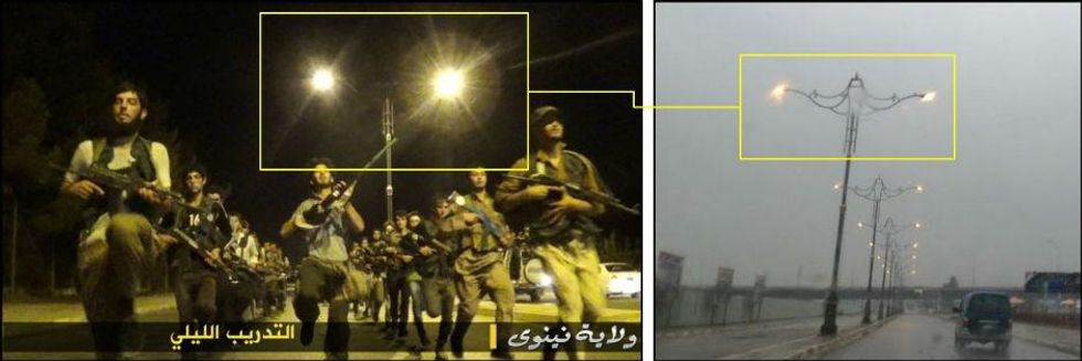
He had never been to Syria and did not speak Arabic. Now, Higgins runs the crowdfunded website Bellingcat, which recently claimed to have uncovered the location of an Islamic State (Isis) training camp using Google Earth; located where James Foley was killed; and spotted the Buk missile launcher which could have downed MH17 inside Russia - all within a month of reaching its funding goal on Kickstarter.
As well as investigations, with Bellingcat, Higgins aims to help educate journalists, activists and researchers about how to geolocate, verify and investigate images and videos that appear on social media. "There’s so few people doing this you could probably put them in a mini bus and drop them off a cliff," he told i100.
"The biggest issue is that there’s far too much for one person to look at."
It is painstaking work - it took Higgins two to three days to identify where Foley was murdered, yet after the video of fellow American journalist Steven Sotloff being beheaded by Isis first emerged online he was asked if he had verified the location almost immediately.
"Because of James Foley everyone expected me to find the address and postcode within the first 20 minutes [of the story breaking]," he says.
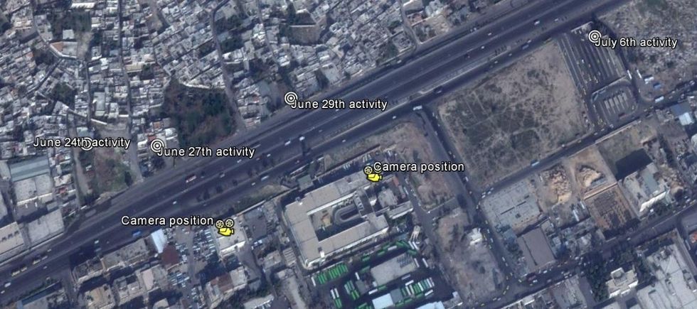
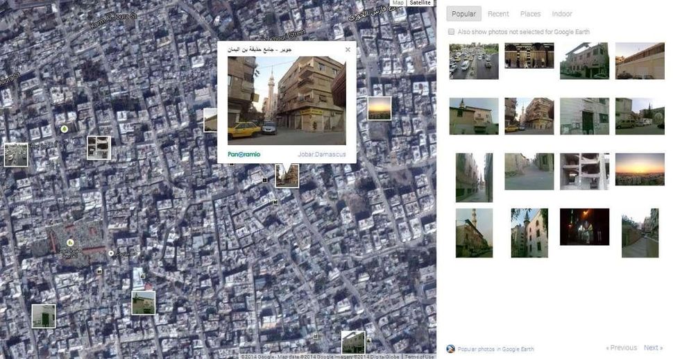
Bellingcat’s 'how to' page explains several techniques for geolocation and verifying. As for the tools he uses? "Most of the stuff I use is easily available and well known. I use Google Earth quite a lot, I use VLC media player a lot. Really, my toolkit is quite small when I think about it."
He also uses Google Maps, Flash Earth, a site using Bing Maps, and Panoramio, a Google site which tags the location photos were taken on a map.
Higgins has been writing about Syria for two years, and monitors more than 1,000 YouTube channels looking for information about the region and the weapons used there.
He first noticed the emergence of Isis in mid-2013. “Their ‘coming out’ video involved three executions in the middle of the square in Raqqa. That’s a big statement to make for one of your first videos.”
As someone who has catalogued many of the weapons involved in the Syrian war - including cluster bombs - as well as exposed the use of chemical weapons by Assad’s government against his own people, Higgins says he isn’t so concerned by Isis’s cache of weapons.
“They’ve always had artillery, they’ve just got a bit more of it. The US air strikes, if they hit all the heavy equipment, stuff like tanks, then it’s going to be difficult for them to replace.”
And if the US does strike Syria, Higgins thinks we’ll be able to see much of it online due the number of social media users in the country.
As for his next steps? Higgins is working with the Organised Crime and Corruption Reporting Project in a plan funded by Google, using the same tools he uses to uncover weapons trafficking and military bases to expose organised crime, as well as working with a social media company to help collate the mass of the tweets, videos and Facebook posts coming out of Syria by region.
“We’ll organise opposition groups by region, or town. It is something no one has done before with Syria but it’s a huge waste. Social media is a good way to alert you to things to investigate and verify.”
More: These are just a handful of the US weapons Isis has captured
More: What we learnt from the MH17 report and what we still don't know