Ellie Abraham
Feb 12, 2024
Moment volcano erupts on Iceland's Reykjanes Peninsula
Live from Iceland
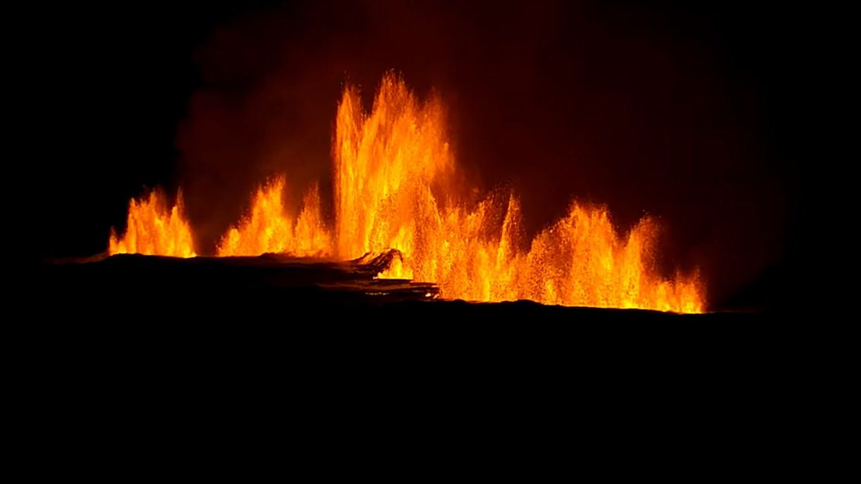
Stunning images from Iceland show lava bleeding into surrounding snow as the volcano there continues to erupt.
In December 2023, a volcano on Iceland’s Reykjanes Peninsula began to erupt after weeks of tectonic activity and earthquakes in the region.
Since then, the Grindavik volcano has erupted a further two times, most recently on 8 February, sending molten lava spewing out onto the Earth’s surface from a giant fissure measuring 1.9 miles long.
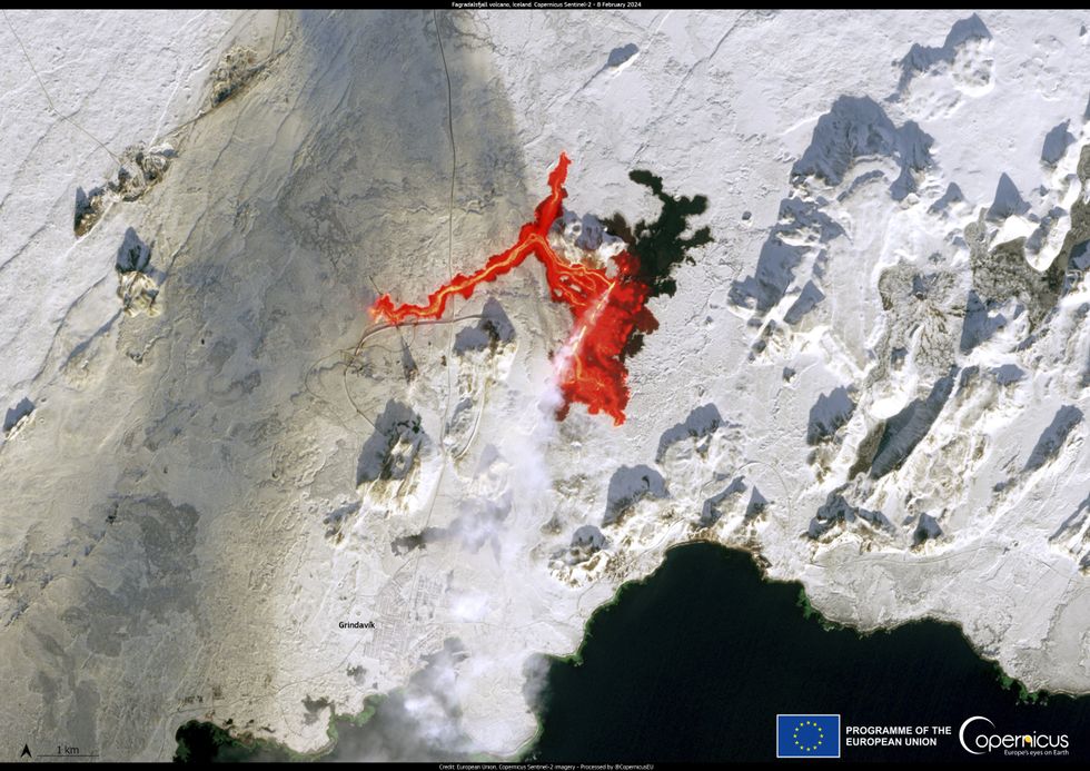
The lava has travelled 2.8 miles west from where it emerged within the planet’s core, and an amazing satellite image has captured its dramatic journey.
The picture was captured by the European Union’s Copernicus’ SENTINEL-2 satellite and taken less than 10 hours after the fissure appeared.
During that time, the image revealed, lava flowed an incredible 2.8 miles west from the site where it erupted, while another smaller lava stream flowed southward in the direction of the Atlantic Ocean through the icy ground.

The flow of lava has disrupted the hot water supply to over 20,000 households in Iceland and has forced the local Civil Protection Agency to raise the alert level to emergency status for the entire Reykjanes Peninsula region, located in the southwest of the country.
According to a statement from Copernicus: “The smoke plume and the lava flow can clearly be seen near the city of Grindavik.”
An update from the Icelandic Met Office (IMO) on 9 February revealed a drone flight at 15:30 UTC observed “no eruptive activity” and it is believed the current eruption has now ended.
Both previous eruptions have last around two days, with the majority of magma being expelled within the first 24 hours.
Sign up for our free indy100 weekly newsletter
How to join the indy100's free WhatsApp channel
Have your say in our news democracy. Click the upvote icon at the top of the page to help raise this article through the indy100 rankings
Top 100
The Conversation (0)


