Sinead Butler
Dec 29, 2022
Another Billionaire Suggests We Revive Dinosaurs
content.jwplatform.com
Earth has been through various changes over the course of millions of years, so it's hard to imagine where modern-day locations would be in those ancient times.
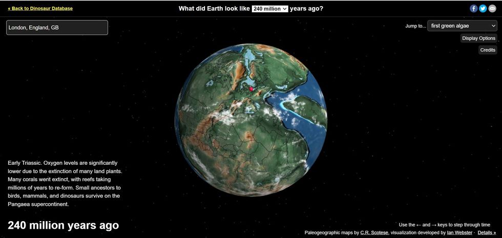
But now there's an interactive map that can incredibly pinpoint what a location looked like at certain periods in history when the planet looked different, for example when dinosaurs were roaming about.
Using paleogeographic maps by C.R. Scotese of the PALEOMAP Project, as well as plate tectonic data, this visualization was developed by Ian Webster.
Sign up to our free Indy100 weekly newsletter
The map at https://dinosaurpictures.org/ancient-earth appears to show what Earth looked like 240 million years ago when the countries we all know today were joined together as part of the supercontinent Pangaea.
But users can see even further back, all the way up to 750 million years ago (though pinpointing specific cities is trickier to do for this time) - e.g. London's location goes back to 600 million years ago.

As the maps go from 750 million years ago all the way up to today, you can see the Pangaea separate as a result of tectonic plate movement into the continents we're familiar with: Eurasia, the Americas, Africa, Antarctica, and Oceania.
While these movements cannot be seen within a human lifetime, the map shows how these slow changes have taken place over the course of hundreds of millions of years.
To see this transformation, desktop users can use their left and right arrow keys to see the continents break apart.
There is also a dropdown option in the top right of the screen that allows users to jump to important moments in Earth's history such as the first green algae, the first land animals, and the first dinosaurs.
For those wanting to look up their location, simply type this into the search bar in the top left corner where some dropdown options should appear, and once chosen a red spot should appear on the map where your location is said to be in that time period.
To try the interactive map for yourself visit: https://dinosaurpictures.org/ancient-earth
Have your say in our news democracy. Click the upvote icon at the top of the page to help raise this article through the indy100 rankings.
Top 100
The Conversation (0)


