The Conversation (0)
Picture:
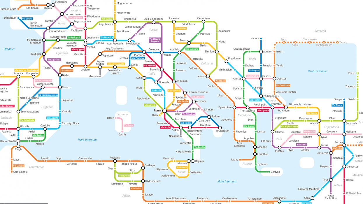
Sasha Trubetskoy
A statistics student at the University of Chicago has created a map of ancient Roman roads as if they were a tube network.
The first Tube Map was designed by Harry Beck back in 1933.
Rather than focus on distance and geographical accuracy, Beck designed it on circuit diagrams for ease of simplicity in reading.
Sasha Trubetskoy has applied the principle to the famed roads of the Roman empire.
The designer told The Local that he always had an interest in Rome, reading the Asterix and Obelix books as a child:
I had the spontaneous idea to model the ancient road network in a modern style.
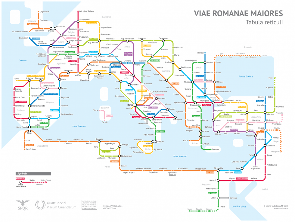 Picture: Sasha Trubetskoy
I was motivated by a desire to produce a high-quality transit-style map, unlike all the poorly designed maps I've been seeing online.
In the description of how he made the map, he detailed the creative liberties he took:
The biggest creative element was choosing which roads and cities to include, and which to exclude. There is no way I could include every Roman road, these are only the main ones. I tried to include cities with larger populations, or cities that were provincial capitals around the 2nd century.
Obviously to travel from Petra to Gaza you would take a more or less direct road, rather than going to Damascus and “transferring” to the Via Maris. The way we travel on roads is very different from rail, which is a slight flaw in the concept of the map. But I think it’s still aesthetically pleasing and informative.
You can pay $9 on his website for a high-res print version of the file, to make a poster.
HT The Local
More: This is the ultimate London Underground map
More: The beautiful maps that show all the roads leading to Rome
Top 100