The Conversation (0)
News
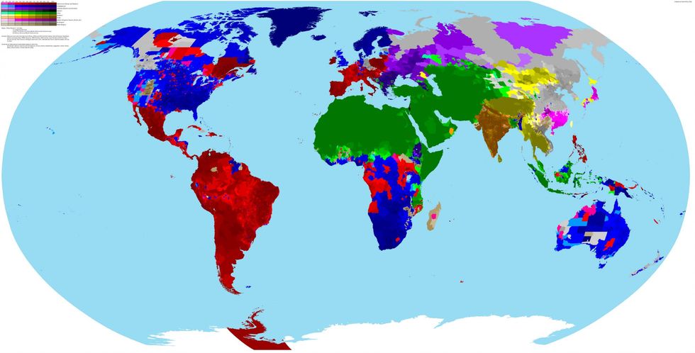
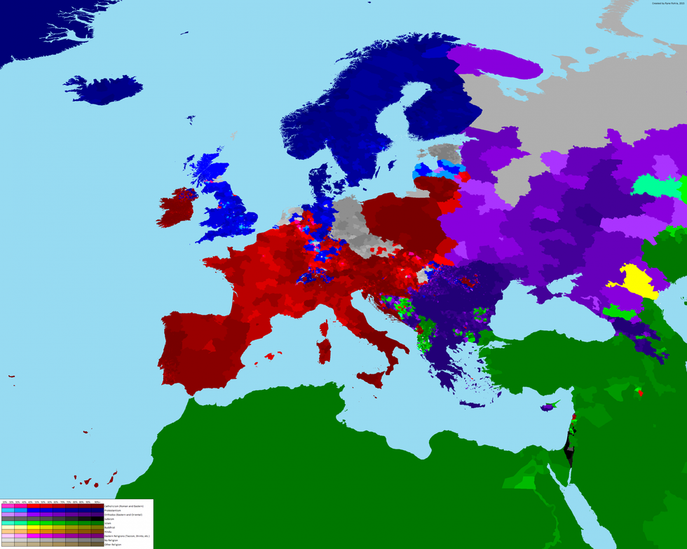
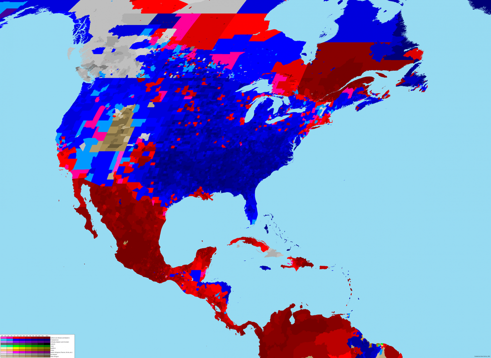
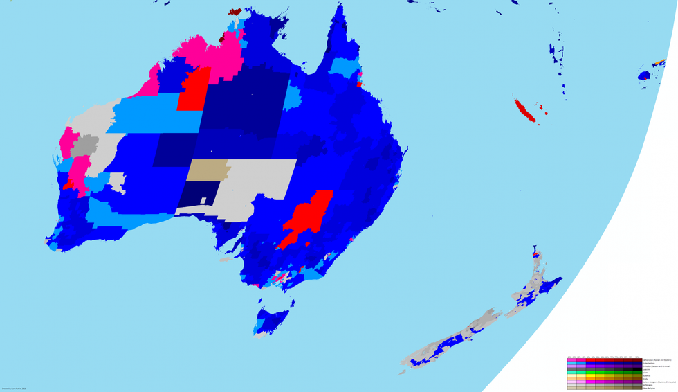
An extremely detailed map of the world's religions, drawing on a wide range of data has been proving popular on Reddit.
Ryan Rohla created the map in 2015, by trawling through government censuses, an online World Religion dataset, Catholic diocese data, Asia Harvest and China Data Online, Pew Forum on Religion and Public Life, and, International Public Use Microdata.
The map goes deeper than the first level of a country's administration in many countries, and in each case Rohla has gone down to the lowest level possible given the data available to him.
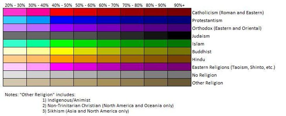
Here is the key to the colours on each map:
For some countries for which the data is either non-existent or inaccessible, Rohla used their most common ethnicity in order to estimate their religious composition. This was the case for many of the countries on the Arabian peninsular, the Central Asian republics, as well as Bosnia and Herzegovina, China, Greece, and Latvia.
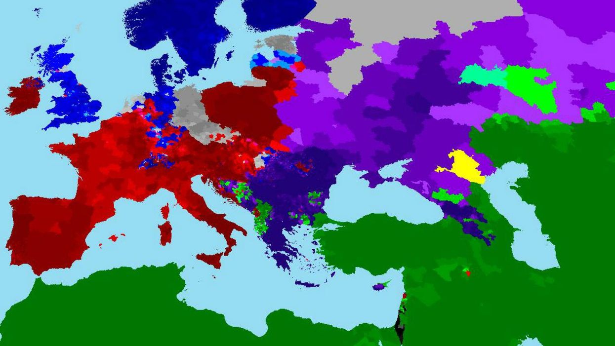
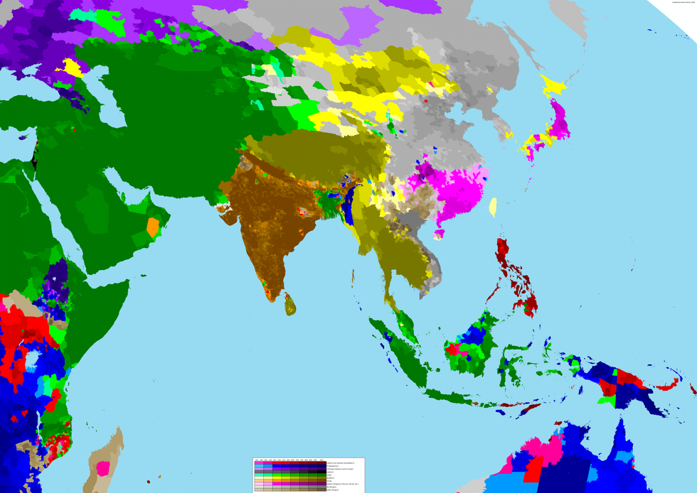
Rohla also provided close ups of four continents:
Pre-empting some questions from other Reddit users Rohla explained some of the details regarding how he collected the data and created the series of maps.
1) This maps shows nominal religion as self-determined by individuals answering census questions, surveys, etc. This does not necessarily indicate their de facto religion; for example, someone may call themselves a Catholic for cultural reasons but not believe in God while another may say they have no religion yet believe in some divine or supernatural force.
2) Islam could not be divided as Christianity was due to data limitations. Most Islamic countries do not ask about specific sects in their surveys and censuses.
3) Scandinavia uses official state church data.
4) The Chilean claim of Antarctica is colored based on Chilean census data for Villa Las Estrellas.
5) The Assyrian population of the Nineveh Plains in Iraq may no longer exist due to ISIS.
The maps also do a great deal to dispel the misconception that countries are each homogeneous with regards to their religious composition. They also highlight the parts of the world where multiple religions meet, such as the horn of Africa, South Asia, and Lebanon.
More: The most dangerous countries in the world for tourists - in one map