


The Conversation (0)
News
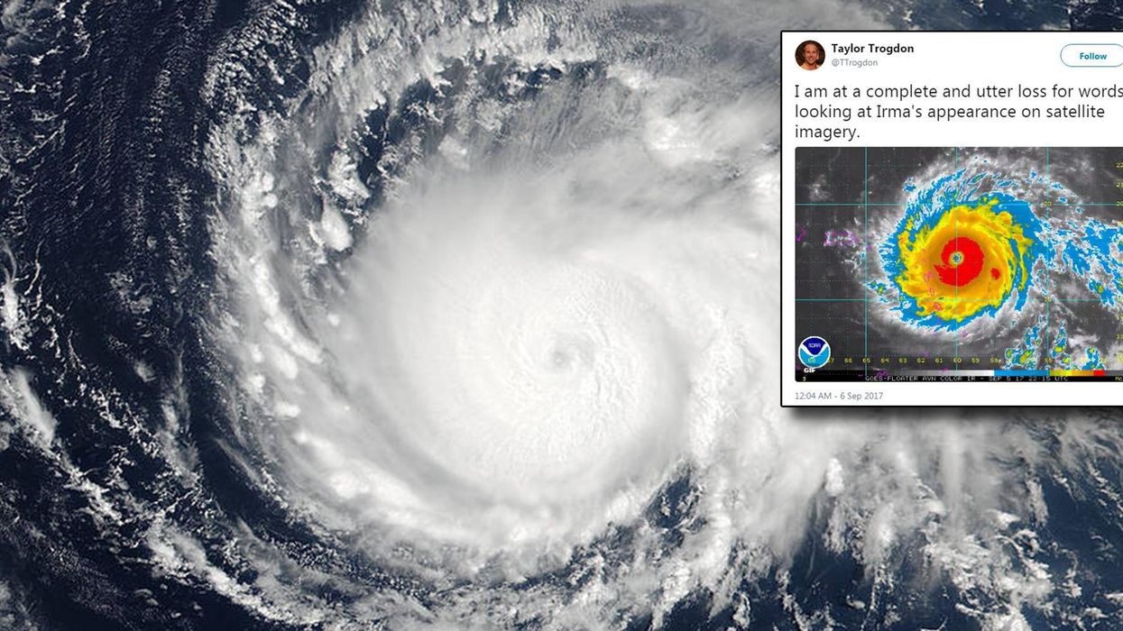
Only a few days after Hurricane Harvey poured record rainfall on Houston, Texas, and the surrounding area - damaging tens of thousands of homes and claiming at least 60 lives - eyes are turning to the building Hurricane Irma.
The hurricane is proceeding over the Atlantic towards Florida, and according to Nasa:
Irma is an extremely dangerous category 5 hurricane on the Saffir-Simpson Hurricane Wind Scale.
Some fluctuations in intensity are likely during the next day or two, but Irma is forecast to remain a powerful category 4 or 5 hurricane during the next couple of days.
Its tied for the second strongest storm ever observed in the Atlantic.
A Hurricane Warning is currently in effect for:
It's not currently known which trajectory Irma will take and whether it will make landfall on Florida, but it's certainly concerning for residents.
More: There's an event to blow away the next hurricane using fans, and thousands are attending