News
Evan Bartlett
Dec 10, 2014

A "weather bomb", characterised by high force winds and huge waves, has already made landfall on parts of the UK and Ireland, leaving thousands of homes without power and causing severe travel delays.
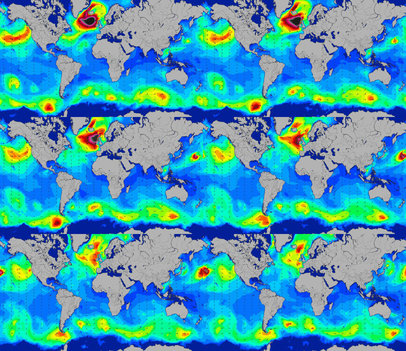
This gif, using a series of still images from MagicSeaweed.com, a website which provides surf forecasts, shows the swell of waves across the world over a period of 48 hours - from the early hours of this morning until early on Friday.
You may also notice from looking at the map that there are currently no bigger waves anywhere else in the world as big as those crashing into Britain.
The colours denote the height of the waves - with black representing swells of over 48ft and yellow at around 20ft.
A weather bomb, also known as an “explosive cyclogenesis”, is classified by a 24 millibar drop in pressure within a 24-hour period.
This intense drop in pressure sees dry air from the stratosphere flow into an area of low pressure, which in turn causes air in the depression to rise rapidly, spiral, and create strong storm winds.
The weather system is set to stay over parts of Britain and Ireland throughout Wednesday and Thursday.
More: Five maps of the 'weather bomb' that's about to hit the UK
Top 100
The Conversation (0)


