The Conversation (0)
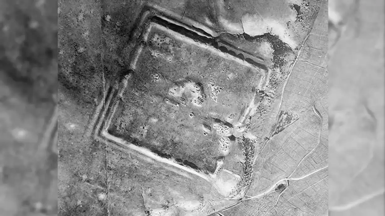
An image of a Roman fort in the region
Casana et al, Antiquity 2023
Hundreds of long lost Roman forts are dotted around Syria and Iraq, according to a new study of declassified satellite images from the Cold War.
Researchers at Dartmouth College found 396 forts in the region by studying imprints in the landscape on the 20th century satellite pictures.
“Archaeological features that we classified as probable forts are easily distinguished from modern buildings due to the distinctive shadows cast by the latter, compared with the lower, eroded walls that are visible at archaeological sites,” they wrote in the journal Antiquity.
Parts of the region now known as Syria and Iran were captured by Rome in 64BC, and remained part of its empire for hundreds of years.
It was strategically located on the silk road, a vast network of trade routes between Europe and Asia, making it both wealthy and important.
For the same reason, Syria and Iraq were heavily fortified against the neighbouring Persians, who lived in the region we now call Iran and were regularly at war with Rome.
In fact, this isn’t the first geographical study of Roman fortifications across the region. In the 1920s, a Jesuit priest called Father Antoine Poidebard counted a line of 116 forts in the area.
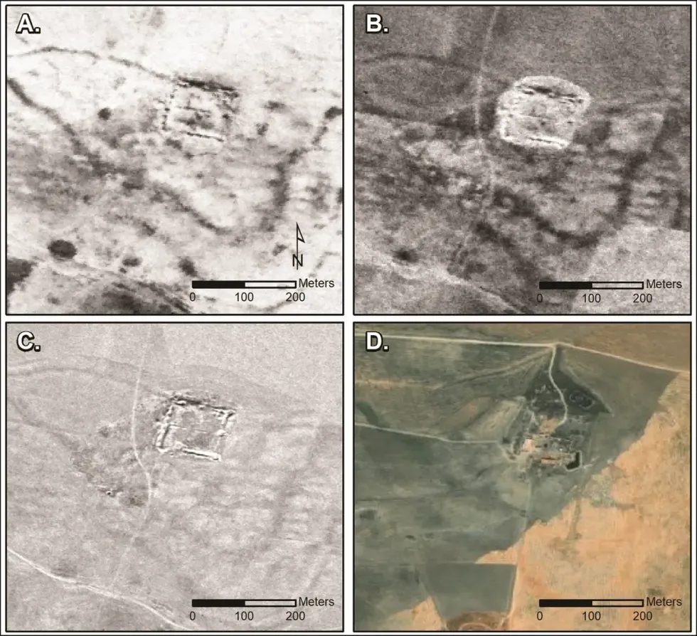 Casana et al, Antiquity 2023
The more recent study only pinpointed 38 of Poidebard’s forts, however, suggesting that many have been lost over the last 100 years amid intense agricultural and urban growth.
The fact that the newly discovered forts are broadly spread east-to-west, rather than north-to-south, indicates that they weren’t just used to protect against Persian invaders from the east, however.
Instead, researchers said the complex could also have been to help the movement of troops and goods across the region, protecting commercial caravans moving through the eastern provinces, for example.
Professor Jesse Casana, lead study author and archaeologist at Dartmouth College, said: “Since the 1930s, historians and archaeologists have debated the strategic or political purpose of this system of fortifications, but few scholars have questioned Poidebard’s basic observation that there was a line of forts defining the eastern Roman frontier.”
“Careful analysis of these powerful data holds enormous potential for future discoveries in the Near East and beyond.”
More and more imagery from the 20th century is becoming declassified these days. In 1997, the US government declassified thousands of photos from U-2 spy planes that flew across the world during the 1950s and 1960s.
Those images are said to be higher resolution than Google Earth, giving the potential for more discoveries like this.
Turns out we might still have a lot to learn about the world from above.
How to join the indy100's free WhatsApp channel
Sign up to our free indy100 weekly newsletter
Have your say in our news democracy. Click the upvote icon at the top of the page to help raise this article through the indy100 rankings.
Top 100