Science & Tech
Harriet Brewis
Oct 25, 2023
Scientists May Have Found Something Massive Living Under Antarctica
Money Talks News / VideoElephant
Scientists have discovered a ghostly snapshot of the land before time buried deep beneath the ice sheets of Antarctica.
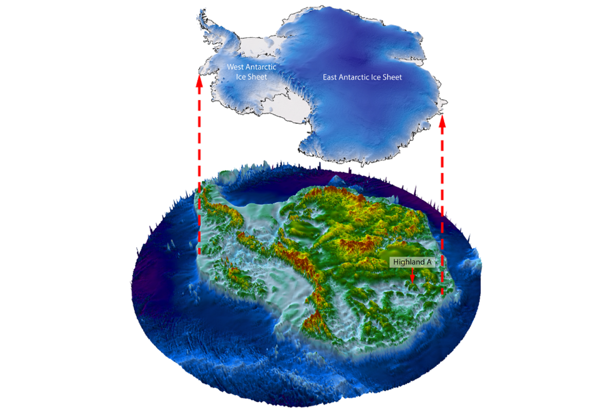
Satellite data revealed that an ancient, river-carved landscape has been lurking there, untouched, for some 34 million years – since before glaciers engulfed the continent.
Most of the buried land was worn away over time by the moving masses of ice. However, new satellite images showed that a patch adjacent to the Aurora and Schmidt subglacial basins largely evaded erosion.
"We could see that there was something like the ghost of the landscape under the ice," geologist Stewart Jamieson, of Durham university, told Live Science.
"At some point in the past, there's been rivers flowing over it, which automatically must mean that it's from before the ice sheet grew."
In a paper published in the journal Nature Communications on 24 October, Jamieson and his colleagues explained how they mapped the region of East Antarctica.
Using preexisting data, they noted how bumps and troughs on the ice surface mirrored changes in elevation in the hidden landscape beneath.
These undulations revealed a "little island of topography" buried 1.2 miles (2km) below the surface and three "blocks" of land separated by U-shaped valleys, Jamieson explained.
These blocks likely formed a continuous landmass, but when the ancient supercontinent Gondwan (which included Antarctica), broke up during the Cretaceous period 145 million to 66 million years ago, tectonic forces may have ripped them apart.
"As part of that pulling away of continents, it's probably stretched our landscape and broken it up into those three blocks," the professor said.
When the climate eventually cooled, ice caps may have formed on top of each land block and carved out valleys as the ice on the peaks melted and the water trickled down.

The giant ice sheet that still blankets Antarctica today developed around 34 million years ago and smothered the entire continent – freezing the landscape in time.
Still, not all of East Antarctica was preserved, as Jamieson and his colleagues noted.
The weight of the thickest areas of ice caused melting at the base of the ice sheet, thereby generating a thin layer of water.
This caused the ice to grind over the land and eat away at it over millions of years.
However, in the newly-discovered location, the ice didn't grow thick enough to create this layer of water, according to Jamieson.
"When you look at the pattern of ice flow in the region, it's sort of going faster on either side of our landscape. But then on top of our landscape it's going really slowly, and that's because it's basically frozen to its bed," he explained.

What remains unclear is whether or not the landscape stayed completely unchanged for 34 million years or whether periods of warming that deglaciated parts of East Antarctica until around 14 million years ago caused some of the ice above it to melt.
"What would be really intriguing is actually going to that location and drilling through the ice to get a sample of the rock and sediment underneath," Jamieson said. "That would be the only way we could confirm the age."
He pointed out that understanding what lies beneath East Antarctica’s ice sheet will help researchers predict its response to ever-warming conditions.
"We need to understand the shape of the landscape so that we can understand why the ice is flowing the way it does now and how it might react in the future," he said.
Sign up for our free Indy100 weekly newsletter
Have your say in our news democracy. Click the upvote icon at the top of the page to help raise this article through the indy100 rankings
Top 100
The Conversation (0)


